09/14/2011 – Captain Robinson Harris US Navy (Retired), now with Lockheed Martin Mission Systems and Sensors (MS2), provides an assessment of how the new Littoral Combat Ship (LCS) might be used in an irregular warfare scenario. The case described was that of a notional crisis in Nigeria with the need to assist the fragile Nigerian government in protection of its oil infrastructure.
Capt. Harris: The Gulf of Guinea lies at the intersection of the Equator and the Prime Meridian at 00.00 latitude, 000.00 longitude. Looking at the strategic components, the United States gets more oil from Africa, mainly from the Gulf of Guinea than we do from the Persian Gulf, and more from Nigeria than from Saudi Arabia. From Accra, Ghana to Malabo, Equatorial Guinea is 550 nautical miles.
The Gulf of Guinea area is not as large as the piracy threat area off the coasts of Somalia. The piracy threat area off the coast of Somalia is the equivalent of the distance between the US border of Maine and Canada stretching all the way down to Key West.
Our scenario is drawn in part on a Center for Strategic and Budgetary Assessments (CSBA) study, which looked at various naval scenarios including the Gulf of Guinea area.
The CSBA study divided the Gulf of Guinea into two sections: Task Force West and Task Force East. We chose the Task Force East because this is where most of the oil infrastructure is located. The Task Force East area in our Gulf of Guinea scenario is about 73,000 square nautical miles (roughly 340 x 210 nm dimensions), which includes roughly 43,000 square nautical miles at sea.
Indigenous insurgent movements and coastal piracy are widespread in the area, including the close coastal/littoral area. It is significant that our shallow draft LCS can operate within a five-meter curve of the shore, and the five-meter curve is very close ashore in the Gulf of Guinea area. The proximity to the coast is an advantage in our imagined scenario.
SLD: And obviously offshore oil drilling is a growing industry and with it the need to provide for security. Your Gulf of Guinea supposed scenario then highlights the nature of security challenges as well to this industry.
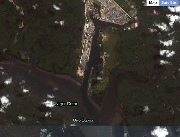
Port of Onne (Credit: http://www.worldportsource.com/ports/maps/NGA_Port_of_Onne_1732.php)
Capt. Harris: For example, a typical pier within the Port of Onne is able to accommodate eight to 10 ships. And every day there are work crews that transit from those piers back and forth to the off shore oil terminals. That represents a 150-mile track which these workboats travel several times every day.
SLD: Similar to our own Gulf situation off of New Orleans.
(See the interview with Admiral Landry of the 8th USCG District)
Capt. Harris: To say the least, the work crew boats are vulnerable to piracy, which is rampant in the Gulf of Guinea. Recently, pirates in the Gulf of Guinea seized two Panamanian-registered ships, staging the second attack there in a week. Additionally, pirates attacked an Italian tanker carrying a cargo of diesel fuel off Benin, making off with some goods but leaving the crew unharmed. Just before that, pirates released a Greek-owned, Liberia-flagged tanker they had seized, also off the coast of Benin. Indeed, if you correlate the offshore oil infrastructure with the occurrence of piracy events you see a significant threat. In addition to the threat of piracy, there are various real or projected inland threats, including Al Qaeda-type elements.
To deal with the threats to their oil infrastructure in this hypothetical situation, the Nigerian government might ask for U.S. assistance.
In this imagined case, the irregular warfare mission might then consist of the following missions:
- Advising police military units to improve quality
- Protecting offshore oil/gas infrastructure and critical onshore facilities
- Engaging in coastal and riverine patrols to provide security in the Delta region
- Conducting counter terrorism and counter-sanctuary operations against al Qaeda-type element in the North.
Protecting Nigeria’s offshore oil and gas infrastructure, in addition to critical onshore facilities, would be a key part of that mission. It would be important to establish wide area surveillance to detect and classify all Critical Contacts of Interest (CCOI) and be able to interdict and board CCOI’s as directed.
SLD: In this potential scenario, the LCS, in effect, functions as your engagement and C2 platform to help identify and prosecute threats to the offshore oil infrastructure as well to provide a partnership element with the Nigerians in this scenario. And it is enabled by various ISR assets which you might have available as well in the region.
Capt. Harris: That’s right. For this hypothetical scenario, we developed a set of notional assets, which Lockheed Martin might bring to bear to work with the LCS. Obviously, there are other potential assets from other companies or countries which could come into play, but we know the capabilities of the Lockheed Martin systems and how they would perform. We placed a lot of emphasis on the role of C2 and ISR. I must point out that this scenario is an excellent example of the value of LCS’s speed which, with its 45 kt capability, would be able to respond quickly to ISR-identified threats.
In this type of scenario we would suggest four tethered aerostat systems similar to the Persistent Threat Detection Systems (PTDS) the U.S. Army has fielded in Iraq and Afghanistan. The tethered aerostats would operate up to 5,000 feet above ground level and would provide broad area coverage with a variety of sensors. The data comes down through the tether or via other media to a small command center.
SLD: These are tethered balloons?
Capt. Harris: Yes. In our imagined irregular warfare setting, we could provide four PTDS units, three of which would be tethered to unused offshore oil rigs in the Gulf of Guinea, and one which would be positioned ashore in the port of Onne. These systems provide fantastic ISR capability.
SLD: Long endurance ISR.
Capt. Harris: Long endurance ISR, relative to the cost of a UAV, is more cost effective. It is truly an effective and affordable persistent ISR. An additional capability could be the high altitude airship, which is in development. Lockheed Martin and the U.S. Army Space and Missile Defense Command (SMDC) had a successful launch of the HALE-D system from Akron, Ohio, in July 2011. The flight test, which ended before the HALE-D could reach the desired altitude, still demonstrated several key technologies, including a closed loop power system (battery, solar array electricity generation), remote piloting communications and control capability, in-flight operations, and vehicle descent and recovery. The lessons learned from the demonstration will pave the way for much larger, operational high altitude airships that will be recoverable, reusable and outfitted for different missions, making it one of the most cost-effective technologies available to the military.
A third ISR capability to consider in this type of scenario would be maritime patrol aircraft. Currently, P3 aircraft are operating out of Equatorial Guinea.
Other assets one might bring to bear in supporting the irregular warfare operation are Lockheed Martin Coastal and Boarder Surveillance Systems, which we currently have installed in Cameroon. For this hypothetical scenario, we suggest the installation to include Chemical Biological Radiological and Nuclear Detection Systems, training teams, 46 in-shore boat units and three LCS’s with embarked mission packages; for example: H-60s, remote mine countermeasures and Fire Scouts.
SLD: The LCS functions as the tip of the spear or the presence or engagement asset, which visibly executes the mission. The ISR assets are in support of such an effort.
Capt. Harris: Correct. The LCS would become the C2 focus platform as well as the launch platform for H-60s, Firescouts, etc. The maritime patrol aircrafts, working with the High Altitude Airship and the PTDS would be able to provide widespread overlapping ISR coverage.
With regard to the PTDS, as I pointed out earlier, one would be deployed ashore, and the other three would be mounted on unused offshore oil platforms.
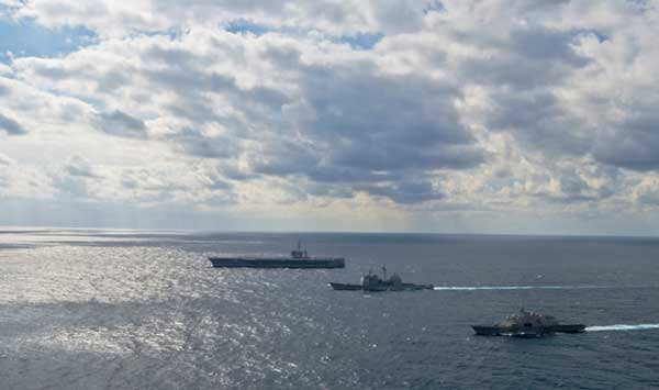
 The littoral combat ship USS Freedom, the guided-missile cruiser USS Bunker Hill and the Nimitz-Class aircraft carrier USS Carl Vinson steam alongside each other in formation. (Credit: USN Visual Service 02/04/2010)
Also, the LCS can be linked to other maritime assets to execute the mission as required leveraging this ISR information. For example, one could imagine the use of a DDG to launch Tomahawks against certain insurgent elements ashore. So such a capability would complement the LCS as needed.
And the LCS can be linked as well to the USN-USMC amphibious team. In this imagined scenario we deploy three LCS’ and one LSD.
LCS provides the speed and presence. Given the 45 knot speed capability of an LCS, the LCS can provide impressive coverage within the operational area to contribute to the mission of protecting the offshore oil infrastructure.
With an H-60 aboard each of the LCS, you would get additional reach and range from the LCS operational area. And if you overlay on that maritime patrol aircraft, or P3 coverage, you would extend as well the reach of the LCS in the operational area.
Capt. Harris pointed out that his study concluded that the postulated platforms and sensors in the hypothetical scenario provide a large, continuous volume of rich data and information from three LCSs, off-board vehicles (P-3, 3-6 H-60, 9+ UAVs, 3+ USV), and off-board sensors to include more than three PTDS. However, currently the On-Scene Commander would not be able fully to leverage all the benefits of Sea Frame/Mission Packages/Off-Board Sensors due to limitations in the ability to fuse sensor data. Harris added that his team is developing an affordable off-the-shelf C2/ISR solution for such a Maritime Irregular Warfare scenario that would enable fusing sensor data.


