

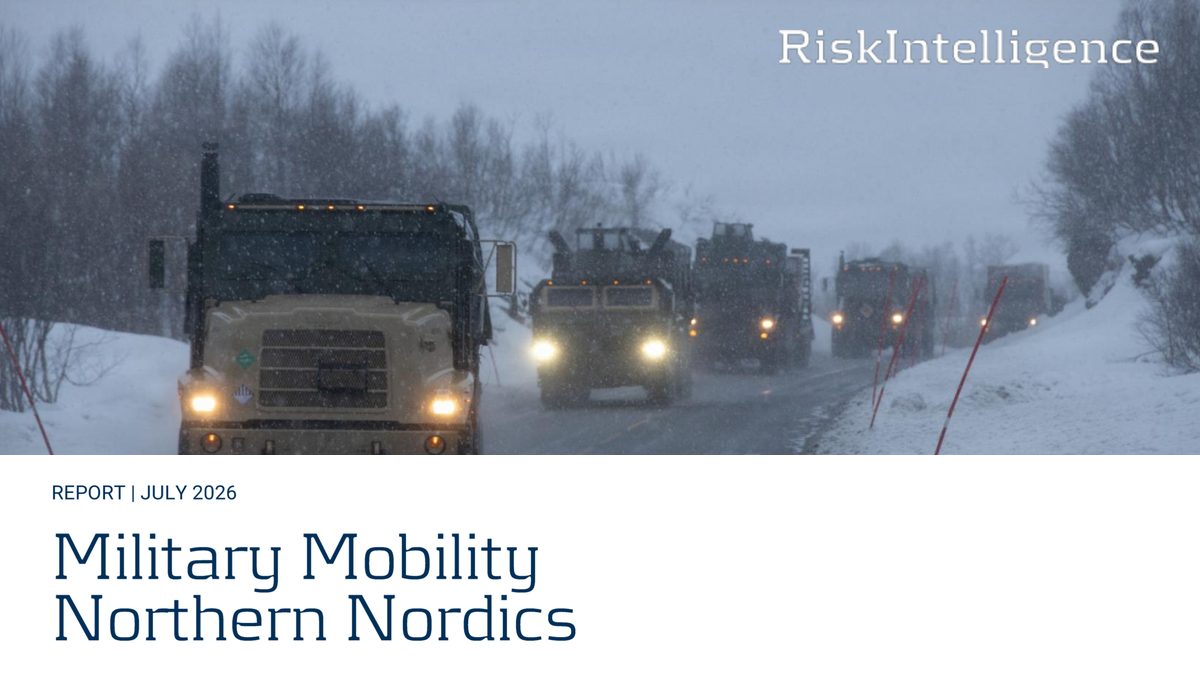
A new study of the Northern Nordics argues that the alliance’s northern flank will be won or lost at the transfer nodes, long before the battlefield.
By Robbin Laird
Every kill web has a substrate. We spend our days on sensors, shooters, decision cycles and the speed at which a distributed force can see, decide and act. We spend far less time on the question that precedes all of it: how the force gets to the place where the web is to be woven. The answer is rarely glamorous. It involves ports, rail sidings, road tunnels, ferry ramps, convoy support centres, and the arithmetic of how many trains it takes to move a tank brigade.
A new report by Risk Intelligence, Military Mobility Northern Nordics: Strategic infrastructure needs for military mobility and security of supply in the northern Nordics, takes that arithmetic seriously. My friend Hans and his colleagues have produced a 140-page study for the Kvarken Council EGTC and the cross-border councils MidtSkandia and Fellesrådet for Trøndelag Jämtland Härjedalen, funded in part through the Interreg Aurora FLINC project. It rests entirely on open sources and on interviews held under the Chatham House Rule. The authors say plainly that none of them has seen classified operational plans, and that they have kept the discussion of vulnerabilities at a level “readily available to people with an understanding of the topic.” They add a line I rather like: “geography is not a secret.”
That candor is the report’s strength. It sets geography every planner knows beside force-flow requirements every planner should know, in numbers a non-specialist can follow. The result is uncomfortable, and useful.
The Region and Why It Matters
The Study Region runs from the Norwegian coast at Helgeland and Trøndelag, over the Scandinavian mountains into Jämtland, Härjedalen, Västernorrland and Västerbotten, across the Gulf of Bothnia at the Kvarken, and into Ostrobothnia and Central Finland. It is the middle of the Nordic map and the hinge of NATO’s northeastern flank.
The strategic logic is straightforward. Arriving units need a port of debarkation close enough to shorten the road and rail march, yet far enough from the Russian frontier to keep the threat picture manageable. Narvik, to the north, is the historical candidate, but one single-track railway and limited port capacity make it what the city itself calls “Norway’s biggest bottleneck,” and the line also carries the ore that supplies roughly 80 percent of what the EU mines. The southern ports around Oslofjord and Gothenburg feed far better infrastructure, but that infrastructure is already busy, and those routes are also the natural path to the Baltic States.
The Study Region sits between those poles. It offers multiple east-west corridors, lighter civilian traffic than the south, and the flexibility to send arriving formations north, south or due east toward Kainuu. With Sweden and Finland now in NATO, the flows run in two directions at once: south to north as Swedish and Norwegian units move to their defensive lines, and west to east as allied formations cross the mountains and the Gulf toward the Finnish border. What was once a national question each country answered for itself is now a multinational one, crossing three borders, two rail gauges and two electrification standards.
The scale NATO has in mind is not modest. The alliance has stood up a Multi-Corps Land Component Command North under Joint Force Command Norfolk. A command of that kind exists to direct corps, each of two to five divisions. In the authors’ words, it is “a clear indication the alliance envisions a scenario where hundreds of thousands of soldiers are operating in Finland, Sweden and Norway.”
Four Scenarios, One Escalating Logic
The report builds on four scenarios drawn from open information, deliberately not meant to reproduce any actual NATO plan.
Scenario 1, the baseline exercise, involves about 25,000 troops, 65 vessels and almost 150 aircraft, much like the largest exercises the region now hosts. It is manageable because it is planned: civilian rail traffic is protected and arrivals are choreographed. Even so, certain nodes run close to capacity.
Scenario 2, the rapid crisis, begins with a Russian demand for a demilitarized zone across northern Finland and parts of northern Norway and Sweden, backed by mobilization in the Leningrad and Moscow military districts. The allied response is fast and light: Royal Marines, the US 2nd Marine Expeditionary Brigade drawing on prepositioned stocks in Norway, elements of the 101st Airborne, French and Italian mountain troops, and the British 1st Division’s light brigades. About 55,000 troops arrive. The problem here is not weight but compression. Units and equipment arrive out of sequence, marrying soldiers to vehicles takes longer than planned, and staging areas fill. Refugee movements, which may be spontaneous (people leaving Trondheim for cabins, say, and heading north toward the fighting), add friction on exactly the roads the military needs.
Scenario 3, the simmering crisis, is the one that should concentrate minds. Weeks of escalation allow a heavy force to assemble: an armoured corps-level formation built around two US Army divisions, the Marine brigade, airborne and mountain elements, corps enablers, and European cold-weather brigades. About 150,000 allied soldiers deploy. The total force in Finland and northern Norway reaches 350,000 to 400,000, of whom 200,000 to 250,000 are Finnish, Swedish and Norwegian. The authors note, dryly, that this is still smaller than what was mobilized on the same geography in the Second World War: Finland alone fielded roughly 390,000 men in 1941.
Scenario 4, the closed southern Baltic, layers a maritime disruption over both crisis cases. Here the report moves from a military problem to a societal one, and it is the part I would most urge readers to study.
The Numbers Behind the Numbers
The report’s most effective device is translation: converting force structure into transport equivalents. Using a simple rule of thumb, one twenty-foot container of lift per soldier to cover equipment and supplies, the vehicles alone work out as follows:
- Scenario 1: about 6,500 vehicles, equivalent to roughly 108 trains or 11 large ConRo vessels.
- Scenario 2: about 14,300 vehicles, roughly 238 trains.
- Scenario 3: about 39,000 vehicles. In the most simplified terms, 114,000 trucks, or 2,300 trains, or 120 ConRo vessels.
The difference between a light and a heavy brigade explains why. The report compares the French ad hoc brigade sent to Mali in 2013, about 1,300 vehicles with nothing over 35 tons, to a US armoured brigade combat team with 80 to 100 main battle tanks above 70 tons each, nearly 20 tracked howitzers and some 450 tracked vehicles in all. The vehicle counts are similar. The logistics are not. Every tracked vehicle needs a train or heavy transporter for any serious distance, and each step up in echelon, from brigade to division to corps, multiplies the footprint by roughly 4.5. “Scaling from brigades to divisions,” the authors write, “creates exponential strain on infrastructure and coordination systems.”
Consider a pure road march in Scenario 3. The authors estimate around 400 convoys of about 100 vehicles each, covering nearly 6,000 kilometres of road between them. At two or three convoys a day on each of six dispersed mountain routes, it would take three to four weeks to get everything through Norway and Sweden and across to Finland. Several of those routes funnel back through Östersund, so dispersion on the map is not dispersion on the ground. Rail is the answer, since one armoured brigade’s vehicles fit on roughly 25 trains. But rail is only as good as its weakest siding.
The Baltic Multiplier
Finland and the Baltic States depend on seaborne trade. Finnish ports handled about 90 million tons in 2024; the Swedish ports likely to be affected handled another 58 million. If the southern Baltic became too dangerous for commercial shipping, as the Strait of Hormuz did, the authors calculate that moving that cargo onto Swedish roads and rails would add roughly 22,600 semi-trailers or 290 trains to the network every day. Each vessel that fails to call at a Finnish port represents about 220 truckloads that either do not move or must find another way.
Escorts will not fix this. The authors count about twenty Baltic vessels suited to escort duty, most not capable in all three warfare dimensions. Even if essentially all of them were devoted to the task, stripping NATO of the ability to do anything else, transit times, turnarounds and maintenance would support only about one convoy every two days to the northern Baltic. That leaves a 75 to 90 percent shortfall in international port calls for Finland and most Swedish ports. Finland’s last refinery, at Sköldvik, takes in about 10 million tons of crude a year and has no substitute.
The implication is that military mobility and security of supply are the same problem. Reinforcing units and the civilian economy that sustains them compete for the same rail paths, ports and diesel. A Scenario 3 deployment into a closed Baltic is not a harder version of Scenario 3. It is a different operation, in which the military force is one claimant among many on a transport system already full.
Nodes, Not Corridors
If I had to compress the report to one sentence it would be this: the most important weaknesses are not the corridors themselves but the nodes where cargo changes mode.
Time after time, the authors find ports with good quays and heavy apron but poor connections to the road or rail behind them. Mo i Rana is the largest Norwegian port in the region by tonnage, with a new deep-water quay and room for 3,600 TEU, yet it lacks a mobile harbour crane and its planned road and rail improvements are unfunded. Staging areas, the open fields where units wait to marry up with their vehicles, are scarce, and in places depend on local industry clearing space before the military can use it.
Transfer nodes are where civilian and military logic diverge. A forestry company builds a spur for logs, a municipality funds a quay for its steel plant, and each is optimised for a single flow. The network as a whole becomes a patchwork of locally rational decisions, “corridors that are optimised to work for individual flows, but show flaws when looked on as part of the larger network.”
The same pattern appears where geography leaves no choice. Norway has been cut in half repeatedly: by the August 2025 landslide that closed both the E6 and the Nordlandsbanen at Levanger, and by a bus fire in the Raudhammar tunnel in March 2026. The Meråkerbanen/Mittbanan, the only rail link between the Norwegian and Swedish networks north of Oslo, is single-track, limited by short sidings, and repeatedly shut by landslides and winter. On Nordlandsbanen, the only way past a blockage north of Hell is to move the train set by sea.
Two further problems are subtler and, I suspect, more consequential.
The first is weight. The Leopard 1 weighed 42.4 tons in combat load; the Leopard 2A4, long the unofficial European standard, 55.15; the new-build 2A8 “nearly 70 metric tons.” That is a 65 percent increase since the Cold War. Ports usually cope, since they are built for heavy project cargo. Road bridges, rail ramps and loading platforms built to earlier standards may not. The authors avoid alarmism, noting that heavy-haulage firms in the region move 100-ton loads weekly, but the routes open to such loads are far fewer than those open to ordinary trucks.
The second is information. Civilian stakeholders repeatedly told the authors that the armed forces had expressed interest in their facility without saying why, when or what would be needed. Without that, no one can tell whether an upgrade helps or hurts military use. The report offers a telling example: making a planned freight terminal at Brunflo, near Östersund, dual-use added 1.4 million SEK to a project costing 72 to 98 million, under two percent. Such bargains are routinely missed because nobody asked, or nobody could say. And the authors raise an uncomfortable possibility about convoy support centres, the military equivalent of motorway service areas. Several planners may be counting on the same scarce portable water, sanitation and lodging contractors, with no one checking for double-booking.
What the Authors Propose
The remedies run from cheap and immediate to generational, and each is rated against the scenarios.
Port connections, ramps and equipment. The cheapest improvements are often the most valuable: better links between quays and the road and rail network, mobile ramps and recertified platforms for 70-ton tanks, and a reserve of the specialist equipment (snow ploughs, cranes, rolling stock, repair crews) that is scarce in peacetime and absent in a crisis. Basic preparedness, the report notes, “is possible at low costs but would yield significant advantages in a crisis.”
Rail capacity. Investment in the Meråkerbanen/Mittbanan is called “one of the most effective single measures for improved military mobility in the Nordic region that does not require the construction of completely new infrastructure”: longer sidings, higher axle loads, better repair capability. The Inlandsbanan, the diesel-run, manually dispatched inland line, is a true redundancy corridor because it is old-fashioned: remote, resilient to weather and attack. Sweden announced investment in April 2026, but decades of underinvestment will take more than a first tranche to repair. A freight terminal at Östersund/Brunflo would add real capacity.
Signalling. The shift to ERTMS/ETCS will remove traditional optical signals. The Swedish Armed Forces have asked to keep them as backup, along with a trained force, perhaps volunteer, able to dispatch trains manually. The authors cite Ukraine’s railways as evidence that older technology is a source of resilience. The digital upgrade that promises capacity could, unprotected, create a single point of failure.
A new line. A railway from Mo i Rana to Storuman, closing a gap of some 200 kilometres, would give Helgeland’s ports a rail route east that avoids the Trondheim junction. The estimated cost is NOK 40 to 100 billion (EUR 3.7 to 9.2 billion). The idea dates to 1872.
Finland’s west coast and the Gulf. The Suupohjan rata, serving the modern, secluded port of Kaskinen, has been closed since 2024. Reopening it would cost about EUR 36 to 60 million at minimum and over EUR 200 million for a full overhaul, against EUR 1 to 1.3 billion for the shelved Pori-Parkano-Haapamäki line. At sea, the Gulf of Bothnia has one Ro-Pax ferry on the Umeå-Vaasa run, the MS Aurora Botnia, which can carry about 300 military vehicles a day. A second vessel would add redundancy. A ship of her class cost about EUR 140 million, though the authors warn that buying a ship is the easy part; operating it profitably is hard.
The Nordic Connector. The most ambitious proposal is a fixed link over the Kvarken between Umeå and Vaasa, estimated at EUR 4.9 to 30 billion depending on bridge or tunnel and whether rail is included. The military case is persuasive. Capacity rises from about 300 vehicles a day to roughly 4,160. Two mode changes disappear. And a standard-gauge rail link would let a unit load at its garrison in France or Italy and ride, via the Øresund Bridge, directly to Vaasa, finally removing the gauge break.
The authors confront the usual objection, that a bridge is a gift to the adversary’s targeting cell. History suggests otherwise. Of five major special operations against bridges and viaducts, the Dambusters, using the heaviest weapons of the war, destroyed one bridge and partially collapsed one viaduct. The Kerch bridge has been hit repeatedly in this war and returned to service within days. One-way attack drones are cheap precisely because their warheads are small. The report allows that conventionally armed ballistic missiles in numbers could change the picture, but concludes that a hardened bridge is no more vulnerable than the convoys, ferries and small river crossings it would replace.
Observations
Three things stand out for me.
First, the mismatch between speed and mass. We talk, correctly, about intelligent mass and distributed operations in the contested zone. The report reminds us that the zone behind it is governed by an older physics. A force that can disperse and fight as a kill web must first be gathered, loaded, moved, unloaded, fuelled and fed, and that process creates exactly the concentrations a web is meant to avoid. Deterrence rests partly on the credibility of the arrival, not just of the force.
Second, the dual-use point runs deeper than it sounds. The report’s closing argument is that no single solution will do, and that coordination across military and civilian, national and municipal, public and private boundaries matters as much as any bridge. Funding is the hardest part. Improvements in Sweden would mainly benefit Finland and Norway in peacetime. Local authorities are asked to spend scarce planning resources on national projects. Privately owned ports and rails cannot be subsidised without distorting competition, and defence ministries seldom have a remit that reaches civilian infrastructure. There is no ready institutional home for infrastructure that is vital to the alliance but commercially marginal to every owner.
Third, resilience is partly a matter of keeping old things. The Inlandsbanan, the optical signals, the manual dispatchers, the volunteer railway corps: none is the future, and all are insurance.
The report is careful about what it does not claim. It does not predict that Russia will attack or that NATO will fail, and it does not reproduce operational plans. What it demonstrates, with unusual clarity, is that the defence of the northern flank depends on unglamorous choices about sidings, ramps, quays, signals, ferries and funding, and that the time to make them is before the crisis.
In the Age of Chaos, the side that can move with confidence will have the advantage over the one that must improvise. The Nordic reinforcement problem is, in the end, a chaos-management problem. The authors have done the arithmetic. The work of acting on it falls to those who control the budgets, the land-use plans and the timetables, who now have a better map of where to begin.
Sources: Risk Intelligence, Military Mobility Northern Nordics: Strategic infrastructure needs for military mobility and security of supply in the northern Nordics (July 2026), commissioned by Kvarken Council EGTC, MidtSkandia and Fellesrådet for Trøndelag Jämtland Härjedalen as part of the Interreg Aurora FLINC project.