
Fifteen photographs from April 13, 2026, at the Chocolate Mountain Aerial Gunnery Range in California document the most operationally complex exercise in the WTI 2-26 series: Assault Support Tactics 1. The photographs span the full operational picture from contractor technicians assembling threat-representative UAS at a mountain observation point, through ground teams climbing to their positions on the ridgeline, to terminal control teams coordinating aviation on the objective, to the large-scale assault itself as helicopters raise dust clouds across the desert floor beside a mock city target complex.
This is the exercise that integrates everything the WTI course has been building toward.
AST-1 is the first major combined-arms integration exercise in the WTI assault support sequence. It brings together assault aviation, terminal attack control, OPFOR UAS threat simulation, ground observer teams, and a realistic objective area into a single scenario that demands coordination across every function simultaneously. The prospective WTI who can plan, execute, and debrief AST-1 has demonstrated the integration competency that the entire first half of the course has been building.
The OPFOR UAS: Contractors and Threat Replication
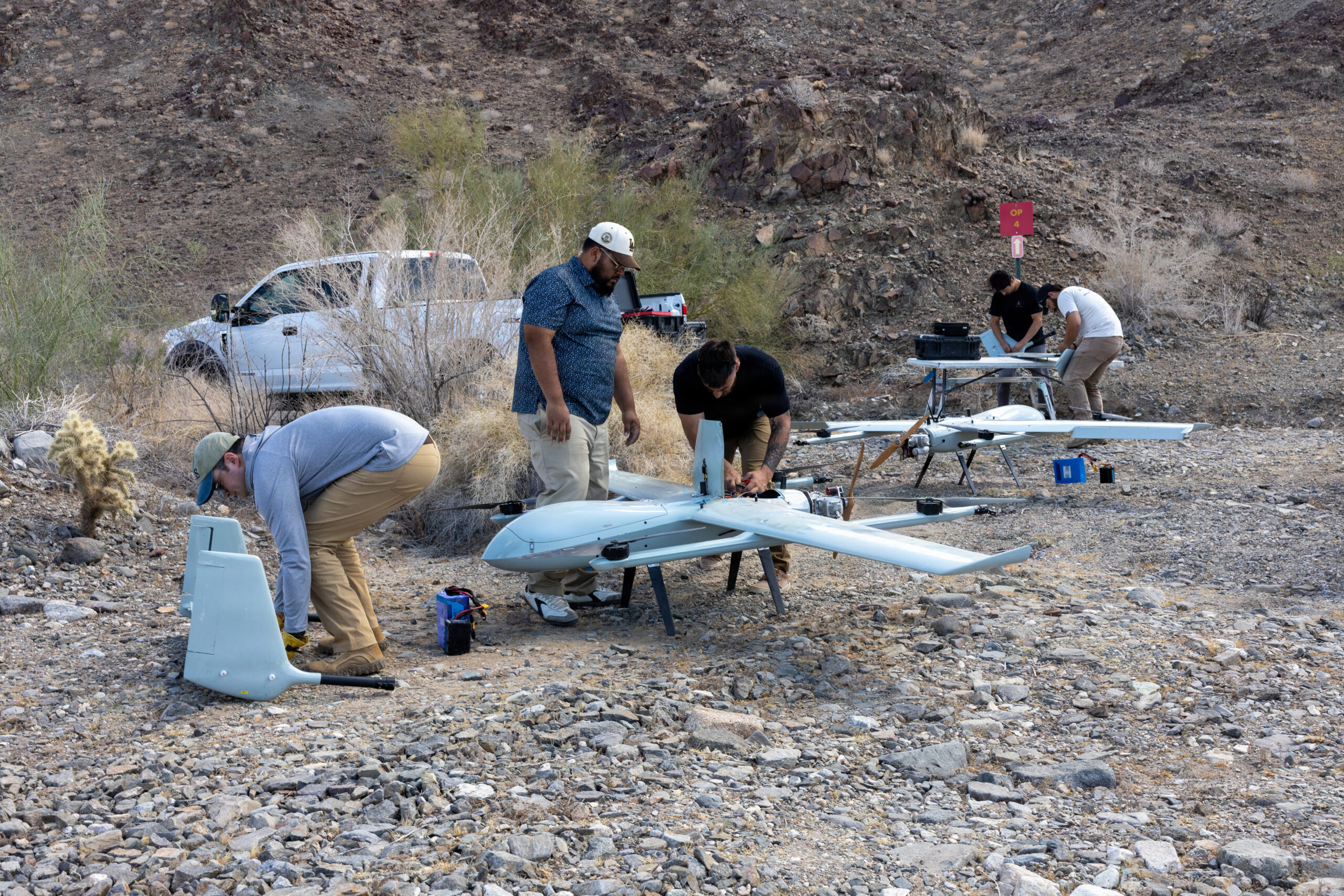
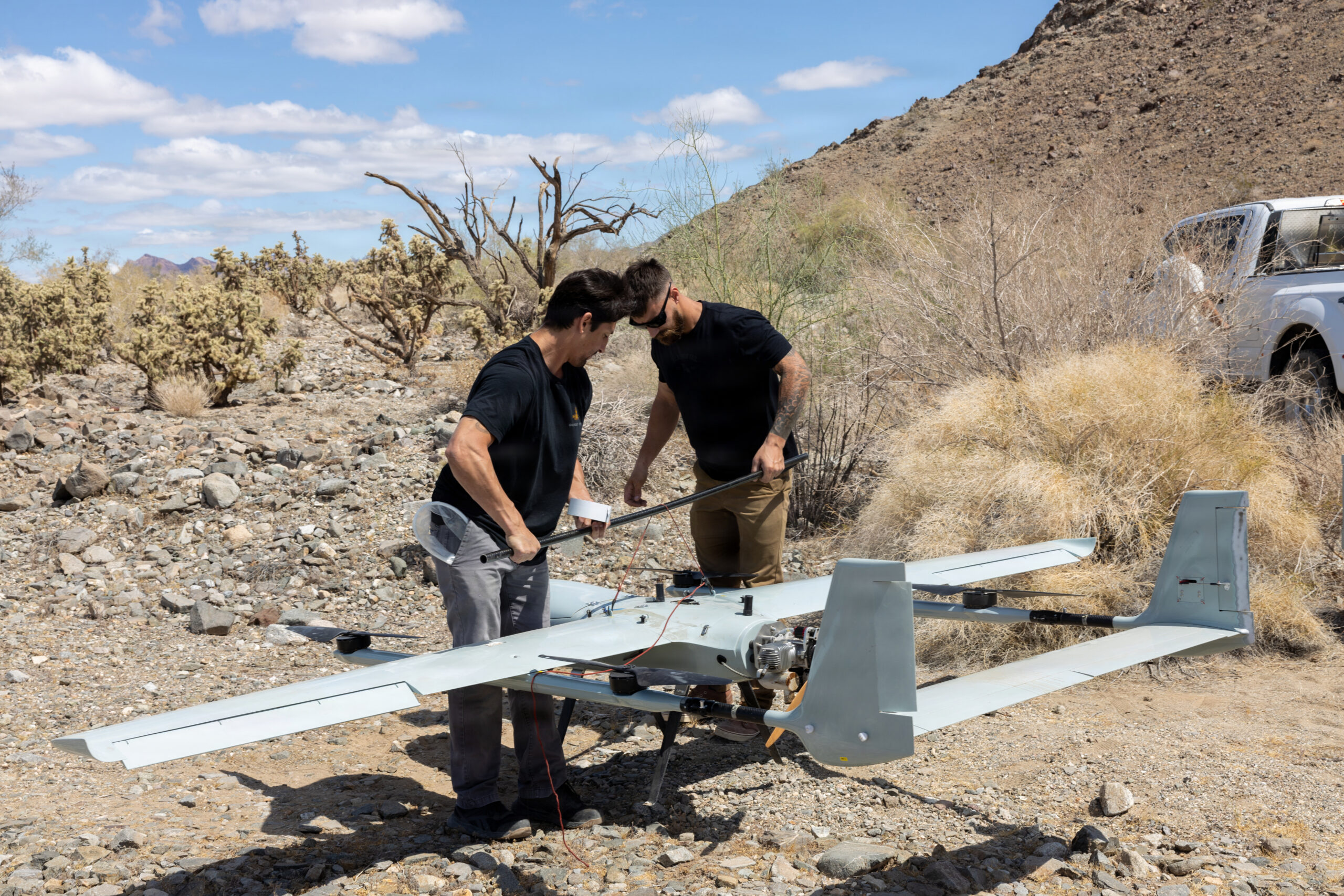
Images 1 and 2 show contractors Emanuel Puerta and Bradley Romeher at Observation Point 4, assembling and balance-checking medium fixed-wing pusher-prop UAS on the rocky desert floor at the base of the Chocolate Mountain range. The aircraft are commercial-military hybrid designs consistent with the threat-representative UAS profiles used across the WTI UAS threat simulation program. They will fly profiles replicating adversary ISR drones or loitering munitions against the assault force operating in the valley below.
The use of contractors for the OPFOR UAS role is analytically significant. MAWTS-1 has built a threat simulation capability that replicates the specific flight characteristics, sensor packages, and employment patterns of adversary UAS systems using purpose-configured commercial platforms operated by specialist contractors. This is not a nominal threat marker. It is a realistic replication of the aerial threat environment that Marine assault aviation will face in actual operations.
The balance-point check visible in Image 2 with two operators checking the center of gravity of the airframe is the kind of precision pre-launch procedure that distinguishes a professionally operated threat simulation program from an improvised substitute. A UAS whose center of gravity is off will fly erratically and fail to replicate the threat profile the exercise requires. The contractors are doing the job to standard. The exercise depends on it.
The Climb: Ground Teams Moving to Position
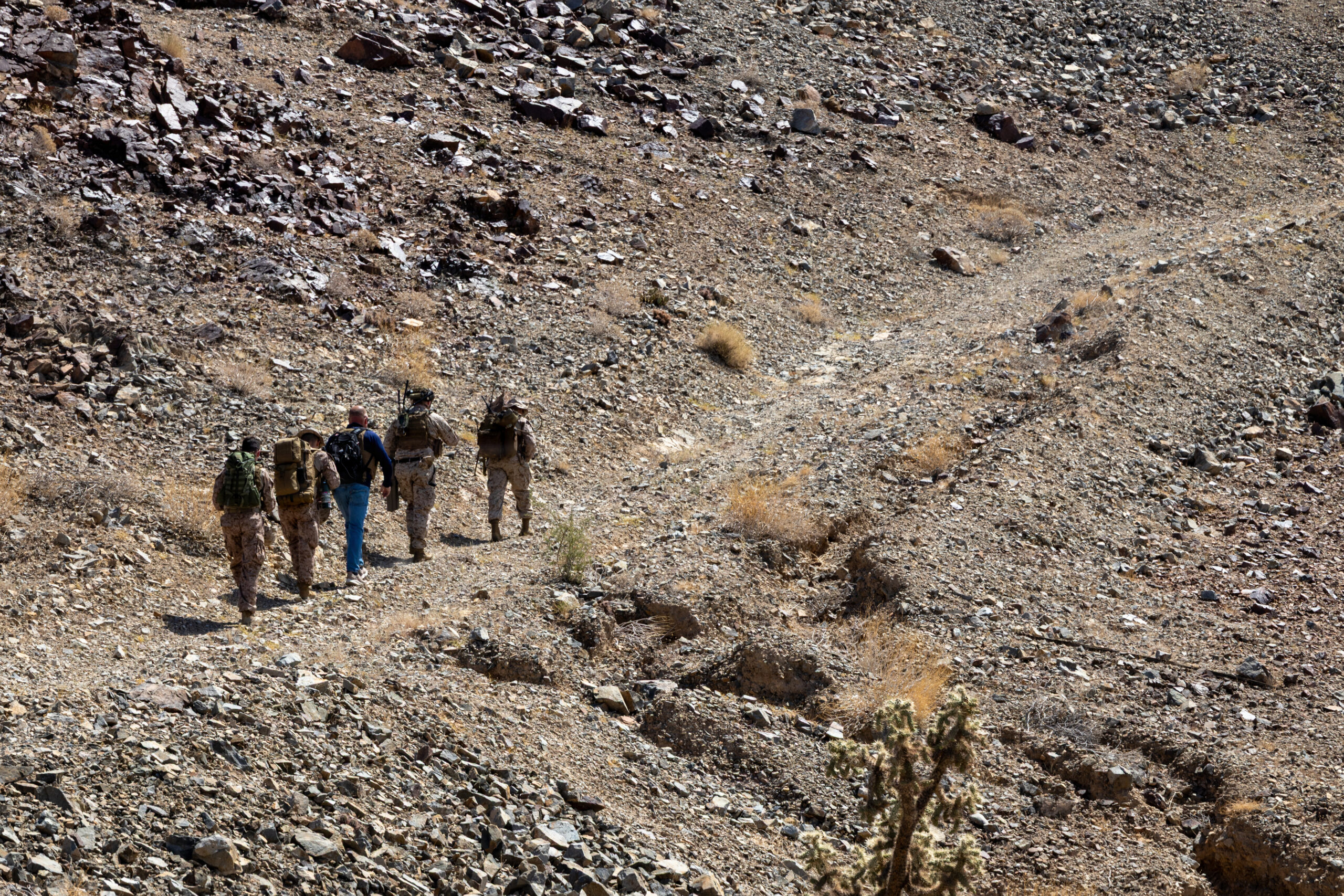
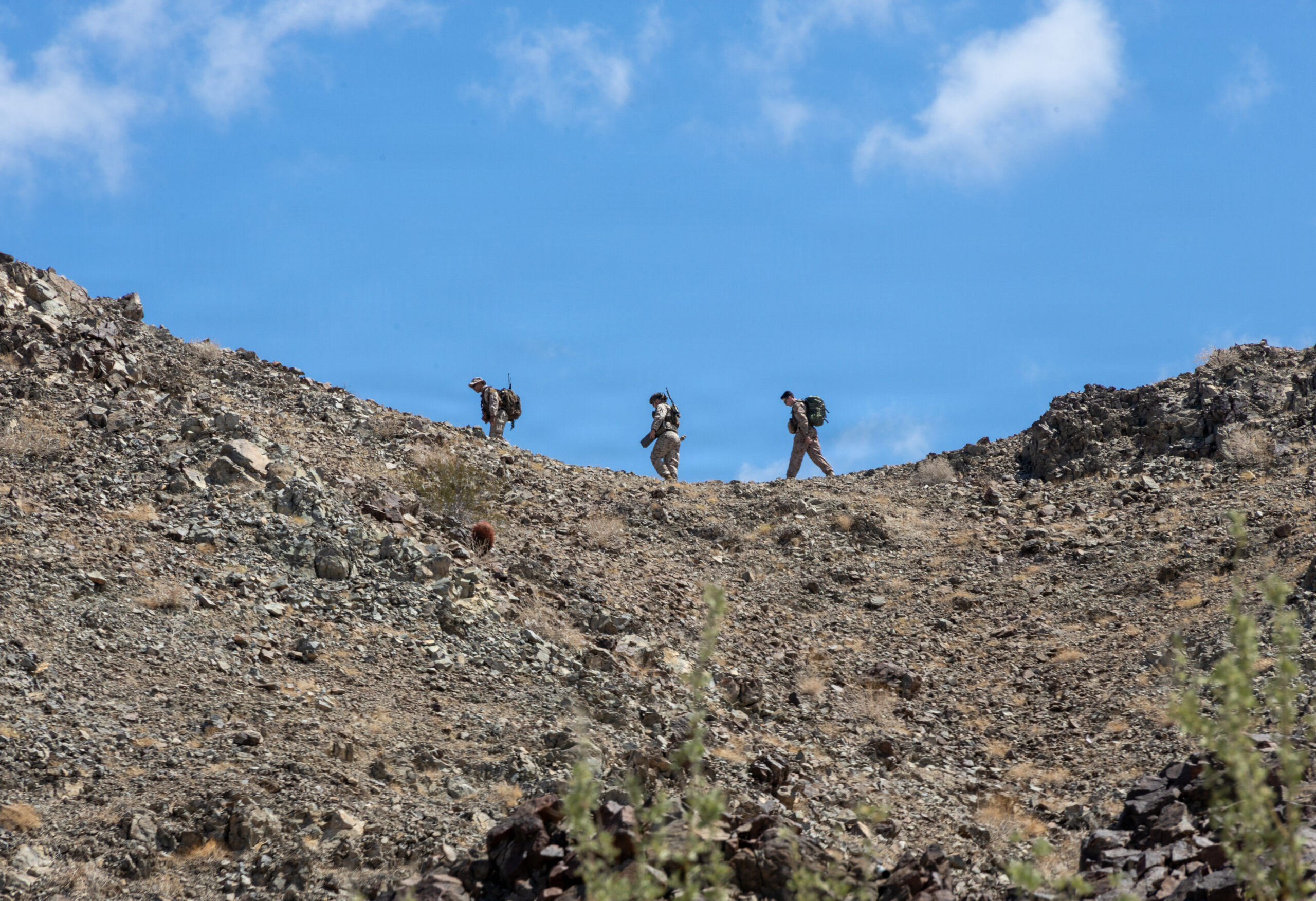
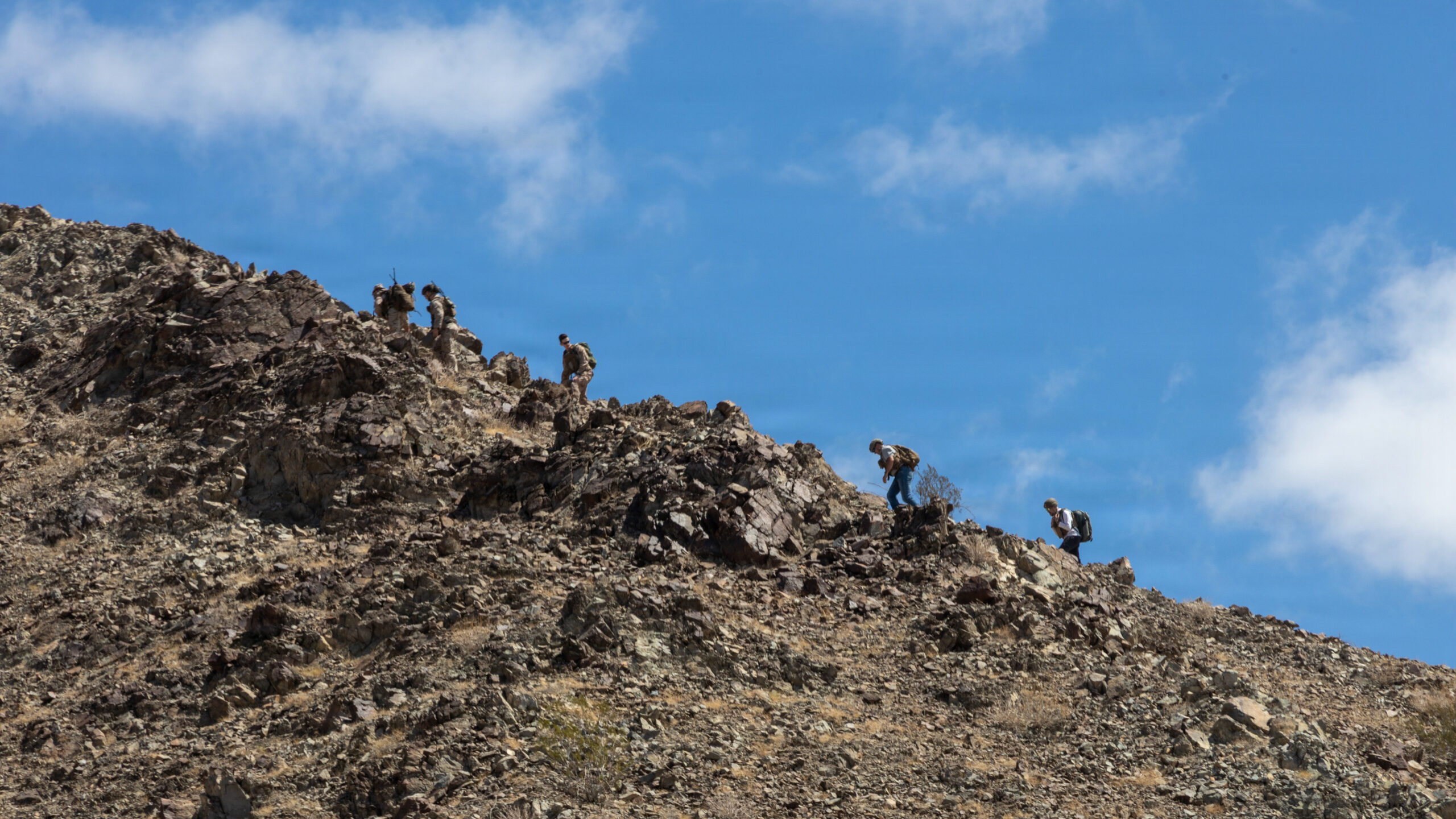
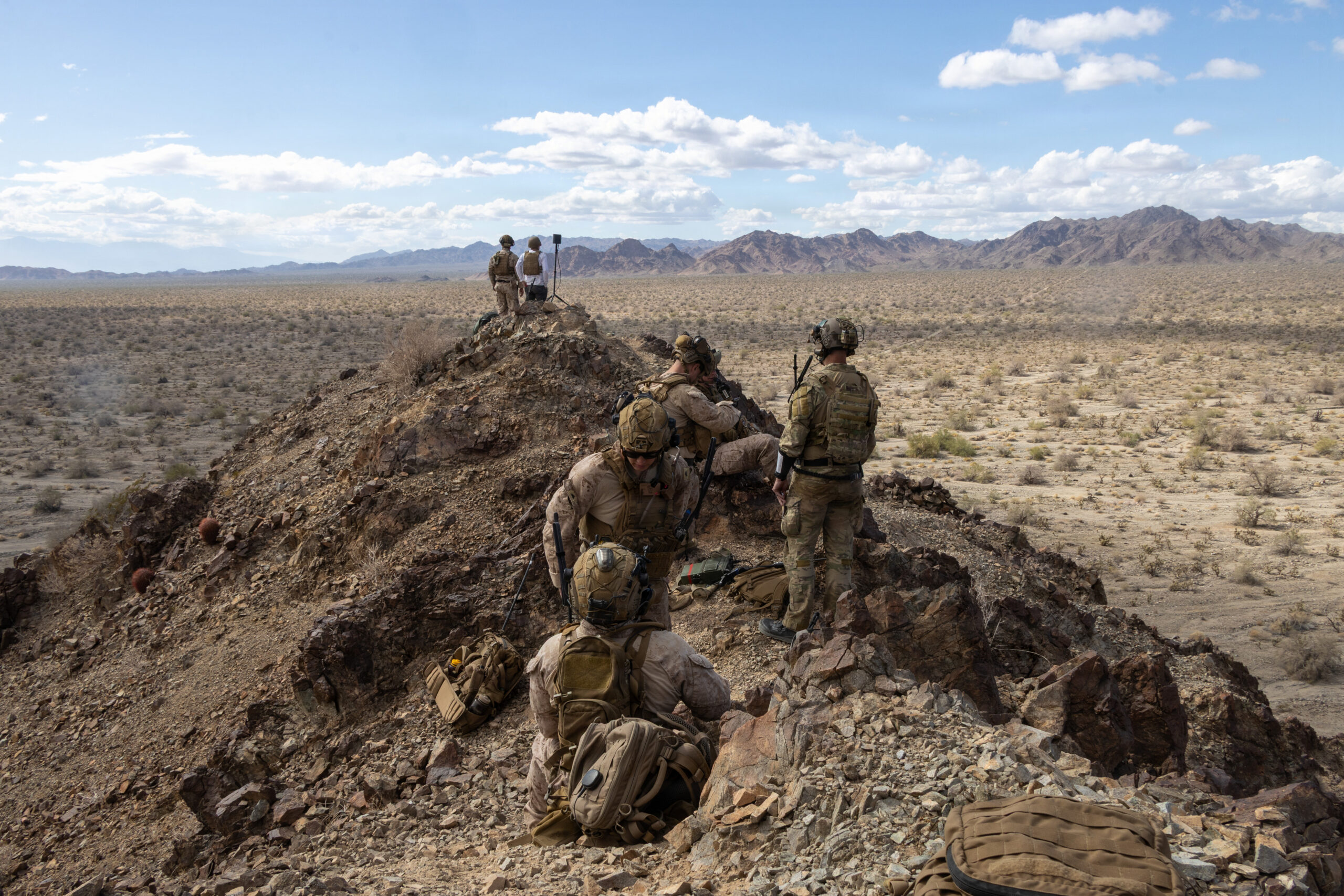
Images 3, 4, and 5 document the approach march of mixed Marine and civilian teams ascending the Chocolate Mountain ridgeline to their observation positions. The terrain is demanding: loose rock, steep grade, no trail, full equipment loads including radios, antennas, and weapons.
Image 5 is the most visually striking of the three: five figures spread across the skyline of the ridgeline, each separated by intervals, all moving toward the crest. The scale of the mountain above them, the hard blue sky behind them, and the spacing of the figures give the image a quality that is simultaneously tactical and austere. This is the physical reality of the terminal controller’s approach march: there is no road to the observation point. The team walks up.
The civilian figure visible in Image 3, blue jeans among the camouflage, is the contractor UAS operator ascending to OP4 alongside the Marine terminal control team. The integration of contractor and military personnel on the same approach march to the same observation point captures the operational reality of how WTI’s threat simulation program actually works: the UAS operator and the terminal controller need to be at the same location, with line of sight to the same objective area, coordinating in real time.
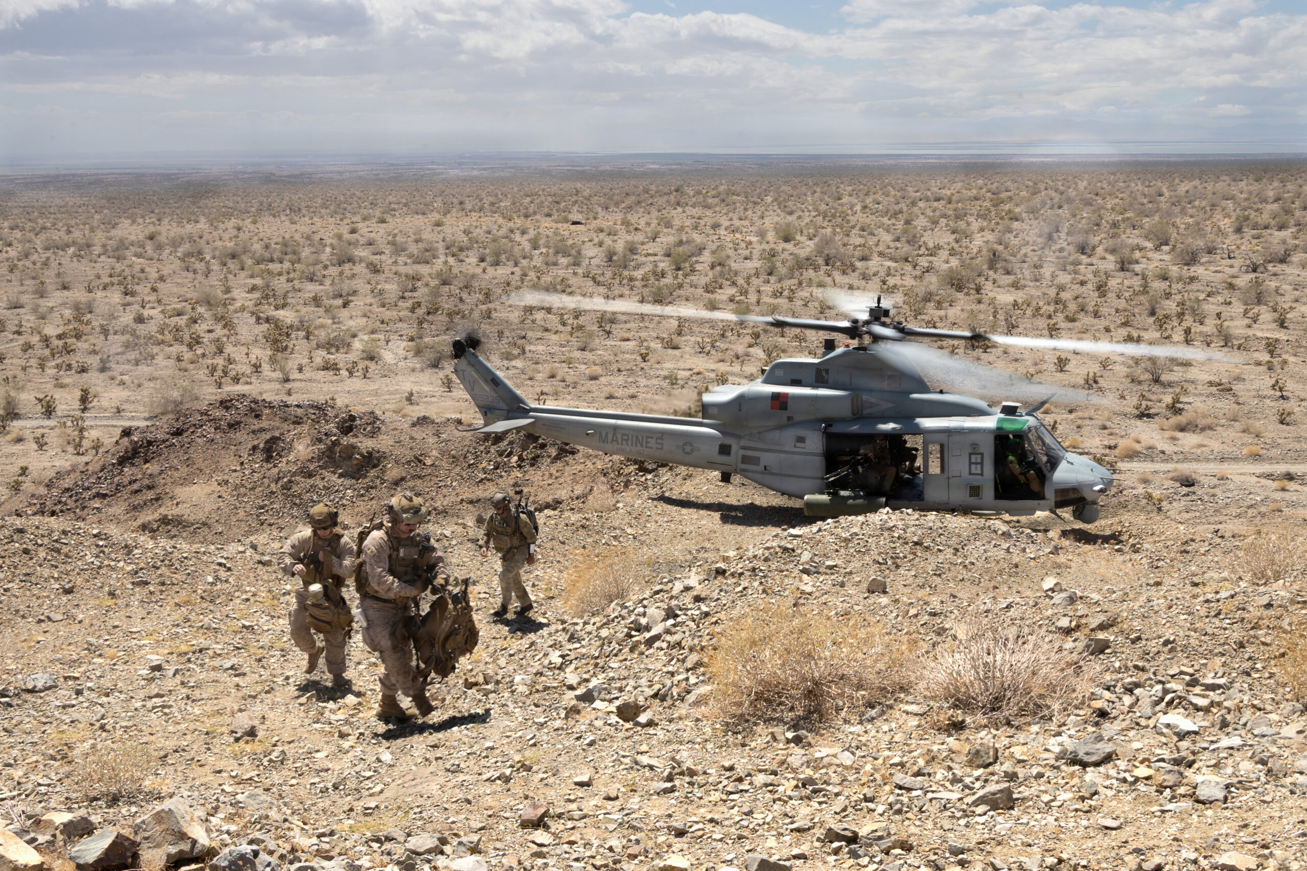
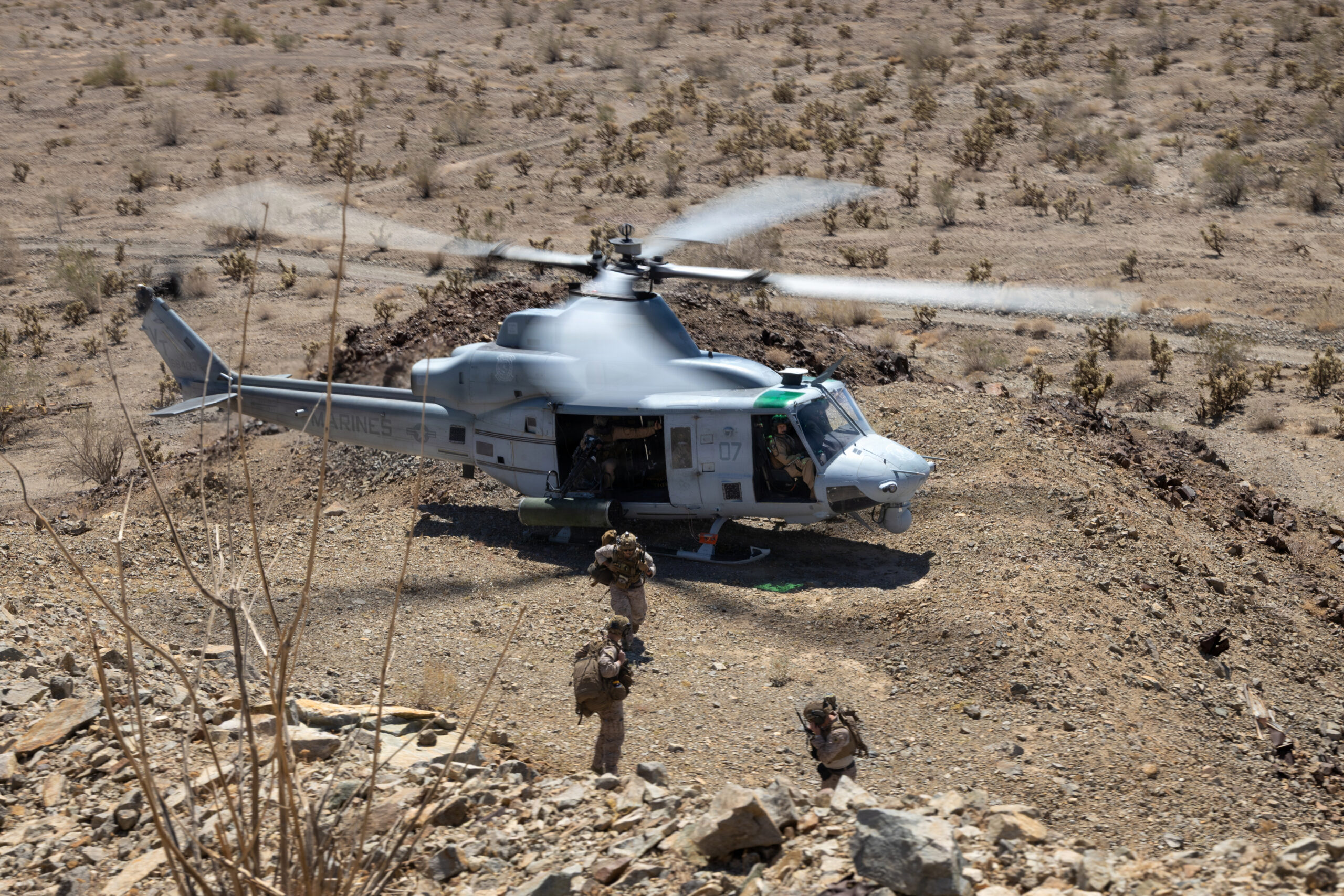
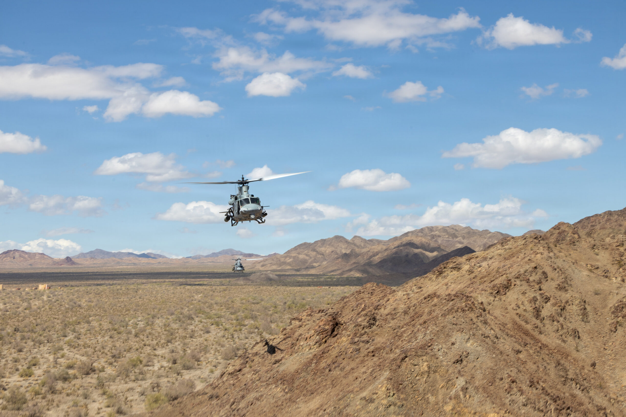
The UH-1Y Insertion: Assault Support Into the Objective Area
Images 6 and 7 show UH-1Y aircraft 17 and 07 conducting assault support insertions at a rocky desert landing zone below the ridgeline. In Image 6, three Marines are moving away from aircraft 17 as it lifts off: the insertion complete, the aircraft transitioning to its escort or overwatching role while the ground element moves to its position. In Image 7, aircraft 07 is on the ground with three Marines approaching, the crew chief visible at the door.
These are not clean airfield landings. The UH-1Y is on unimproved rocky terrain at the base of a mountain, in a confined space between ridgelines, with rotor wash kicking up dust across the desert scrub. The pilots are flying to the ground element’s position rather than to a prepared landing zone. This is the realistic insertion geometry that AST-1 is designed to train: the aircraft goes where the mission requires, not where the infrastructure permits.
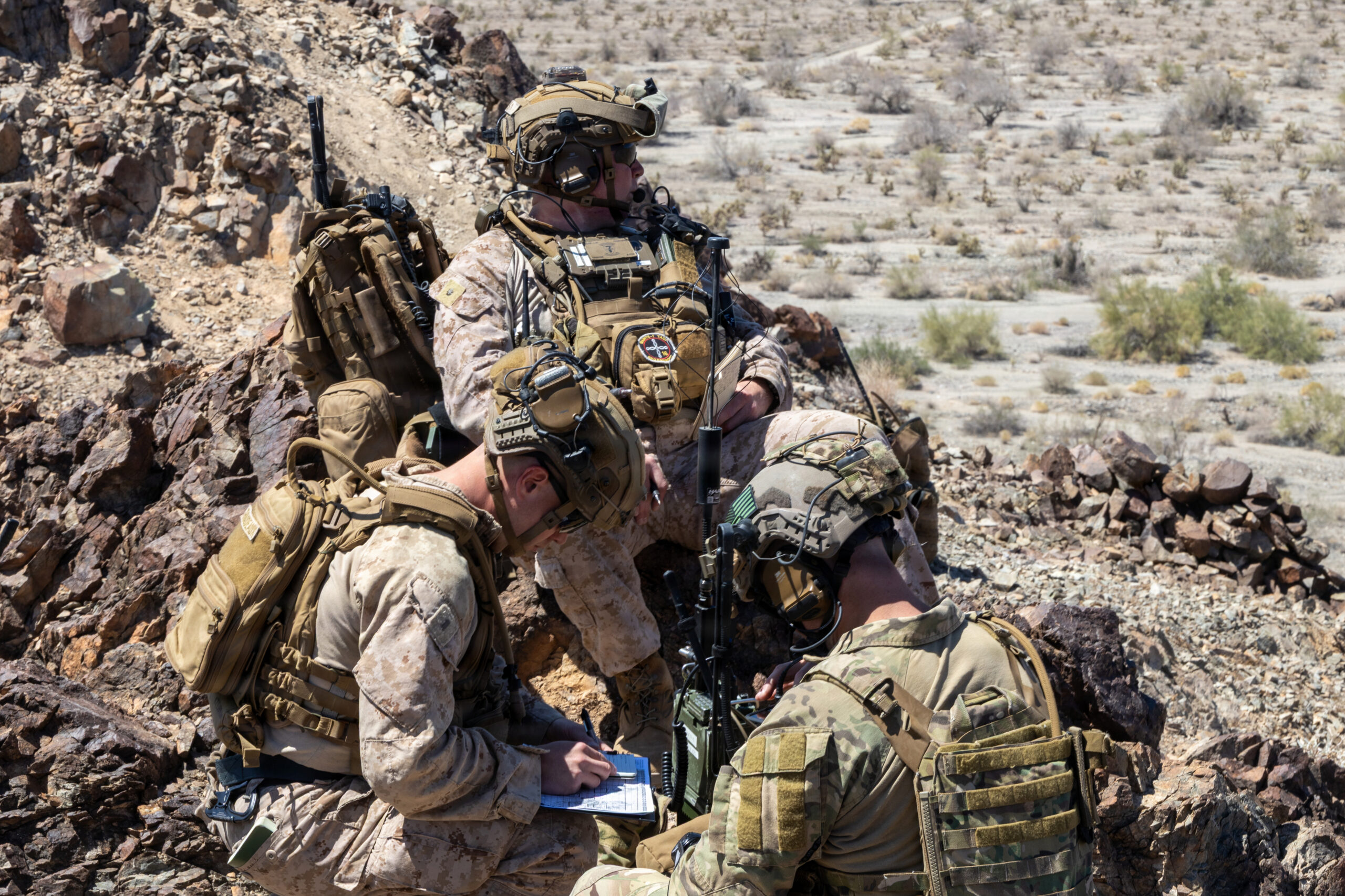
The Terminal Control Team: Three People, One Node
Image 8 is the analytical centerpiece of the ground element photographs. Three personnel are at a rocky ridgeline position: a Marine standing with a full radio kit, NVGs mounted on his helmet, speaking into a handset while scanning; a second Marine crouched and writing on a kneeboard, tracking the control sequence; and an Army soldier in OCP operating a separate radio at the right. A MAWTS-1 patch is visible on one of the Marines.
This is the terminal attack control node which is the human interface between the aircraft in the air and the target on the ground. The standing Marine is the JTAC or FAC(A) in the ground role, controlling the aviation through the radio. The crouching Marine is tracking the control sequence, maintaining the log, and managing the data that feeds the debrief. The Army soldier’s presence reflects the joint integration that runs throughout this WTI series: the terminal control mission in a real contingency may involve Army, Air Force, or partner-force controllers working alongside Marine aviation.
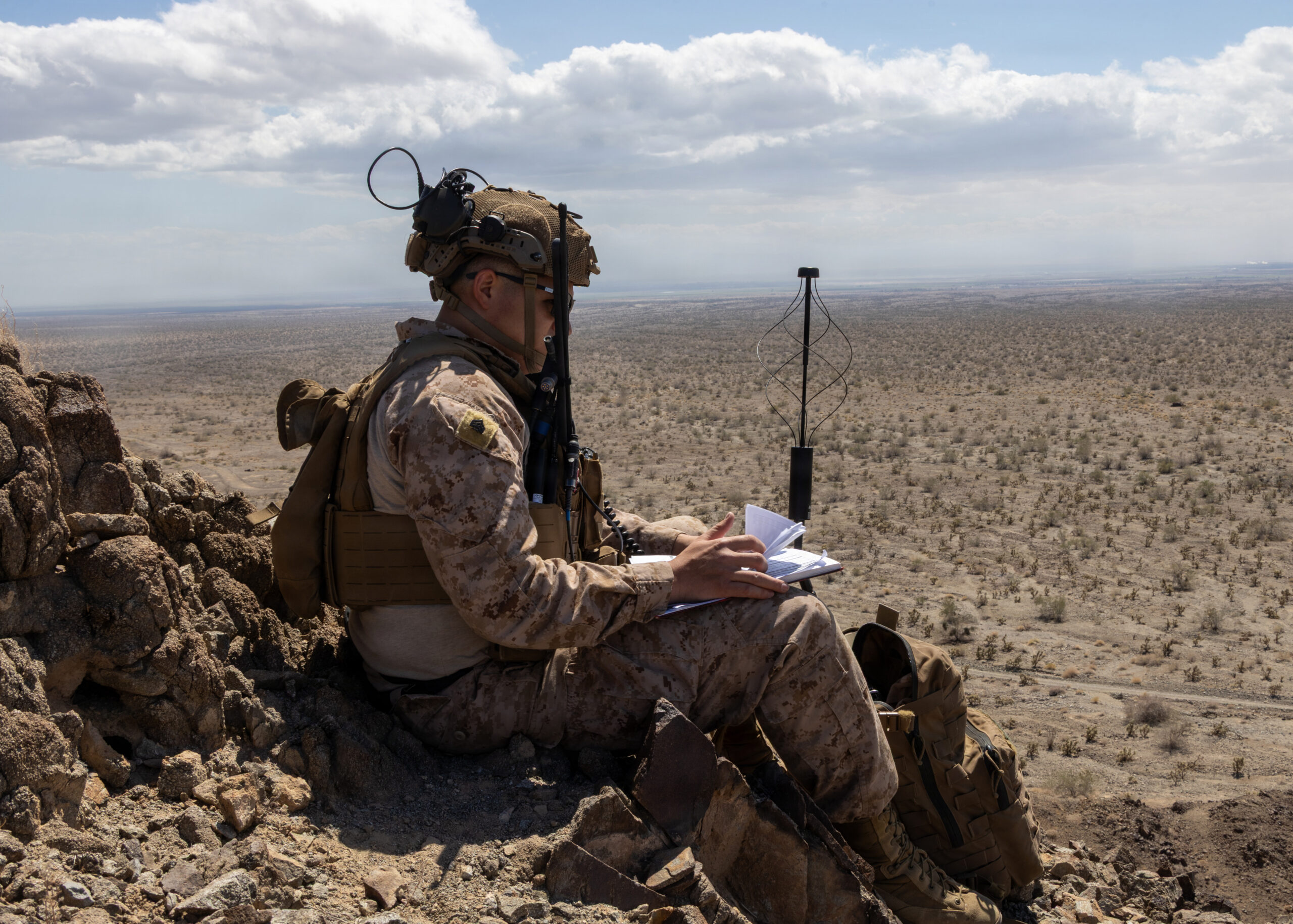
Image 9 shows a single Marine at the ridgeline crest, seated with a notebook, a radio mast deployed beside him, looking out over the desert floor below. The view from his position encompasses the entire objective area — the mock city, the landing zones, the approach routes for the assault aircraft. This is the observer’s vantage point: elevated, unobstructed, with communications and the entire battlefield spread out below. The photograph captures the spatial relationship between the terminal controller and the fight in a way that no other image in the series does.
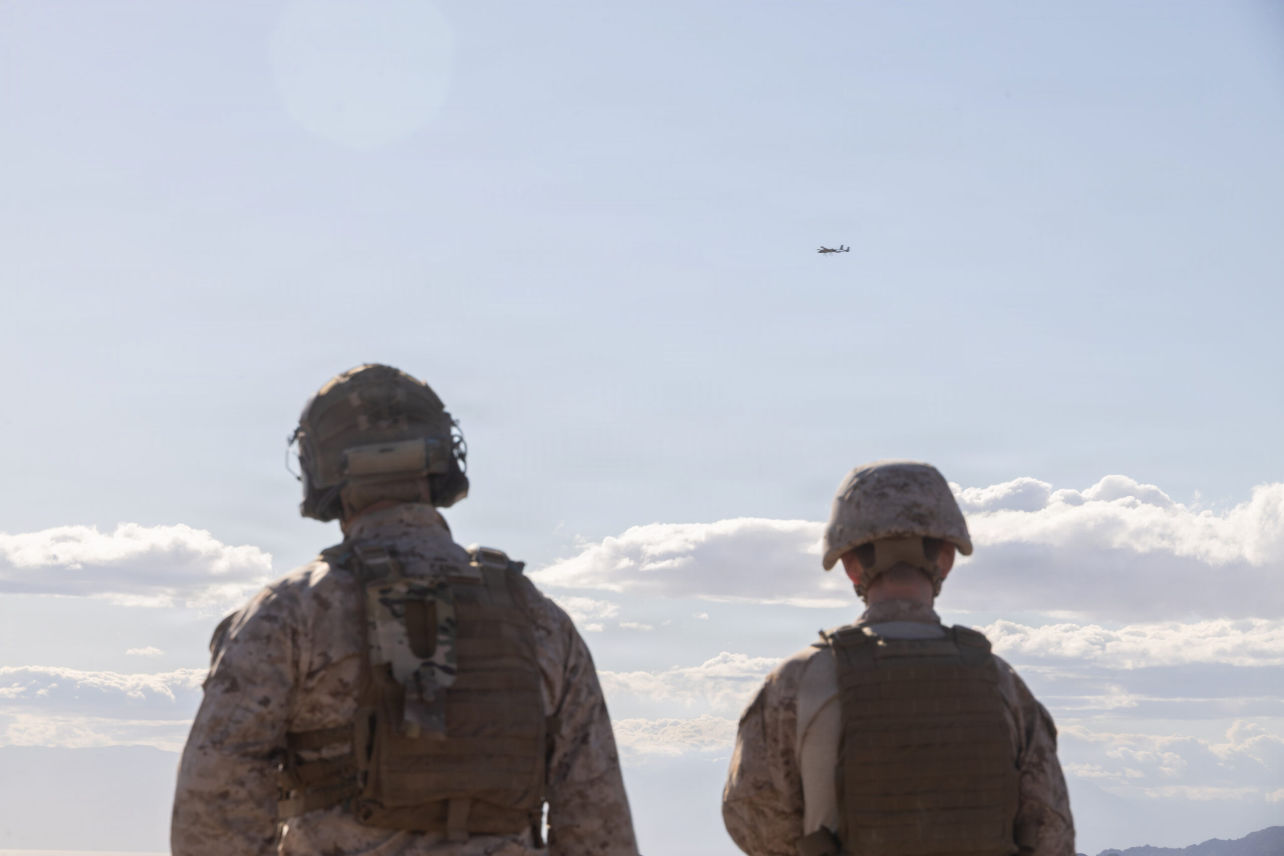
The UAS Threat Over the Range
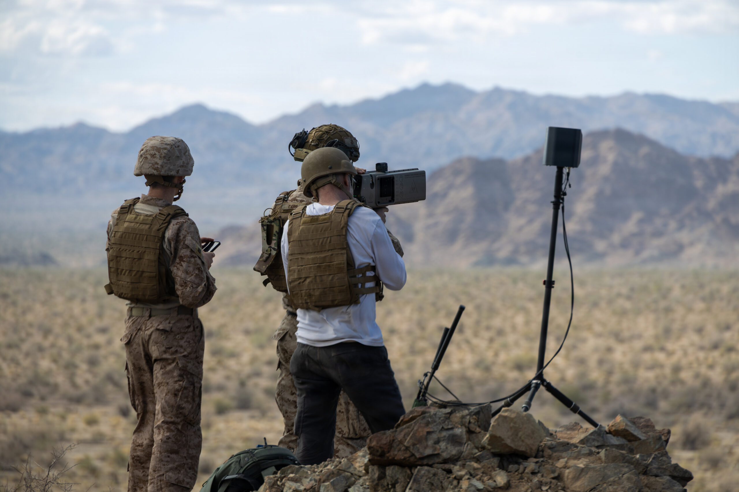
Images 12 and 14 document the OPFOR UAS element in operation. Image 12 shows the contractor at OP4 operating an EO/IR spotting or UAS control device on a tripod — a Marine beside him checking a tablet — while the mock city target complex is visible across the desert below. Image 14 shows two Marines from behind, watching a fixed-wing aircraft, one of the contractor-operated threat UAS, flying at altitude over the range.
The two figures watching the UAS in Image 14 capture the essential tactical problem that AST-1 is training. The aircraft is small, fast-moving, and at altitude. It could be conducting ISR on the assault force, providing targeting data for a notional adversary fires system, or itself be a loitering munition. The assault aviation package, the UH-1Ys inserting the ground element, the heavy assault helicopters approaching the mock city, is operating in an airspace that includes this threat.
The integration of a realistic OPFOR UAS into AST-1 is what distinguishes this exercise from the assault support training of the previous generation. In past WTI iterations, the dominant threat to assault aviation was fixed-wing fighters, surface-to-air missiles, and anti-aircraft artillery. Those threats remain. But the UAS threat, small, cheap, numerous, increasingly capable, now shapes the planning, the routing, the timing, and the self-protection calculus of every assault support mission. AST-1 builds that threat into the exercise from the ground up.
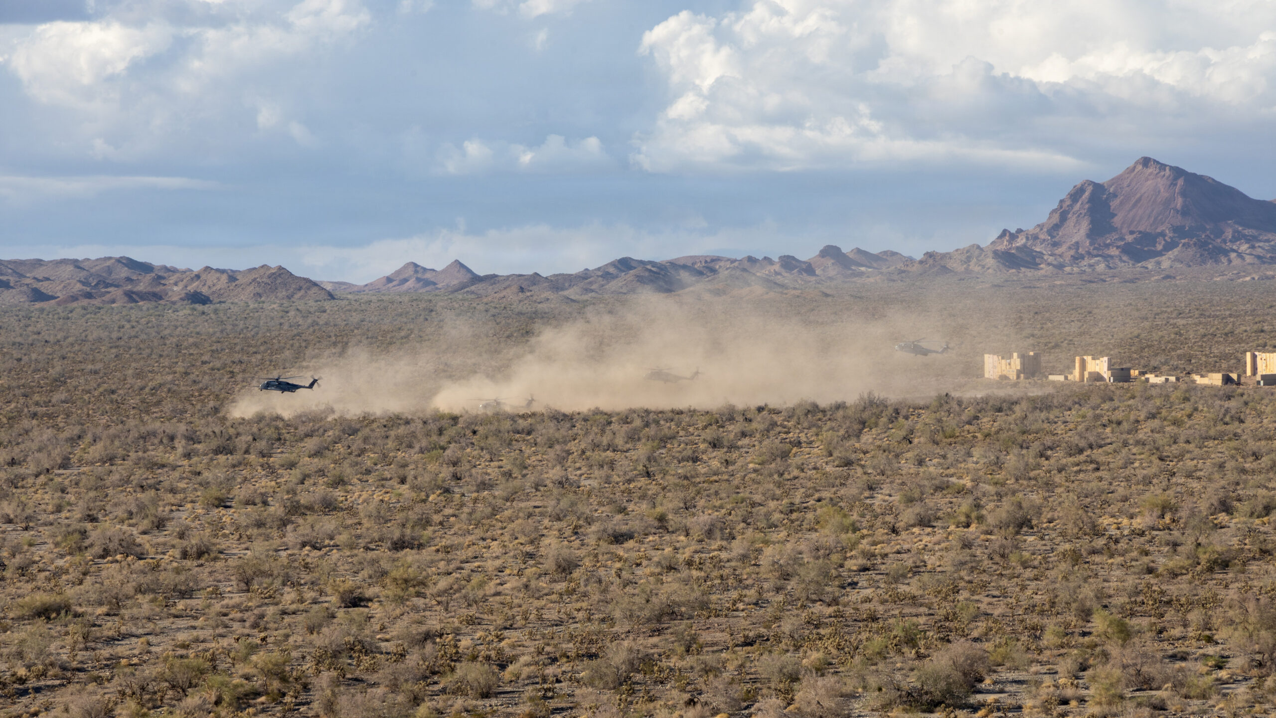
The Mock City and the Large-Scale Assault
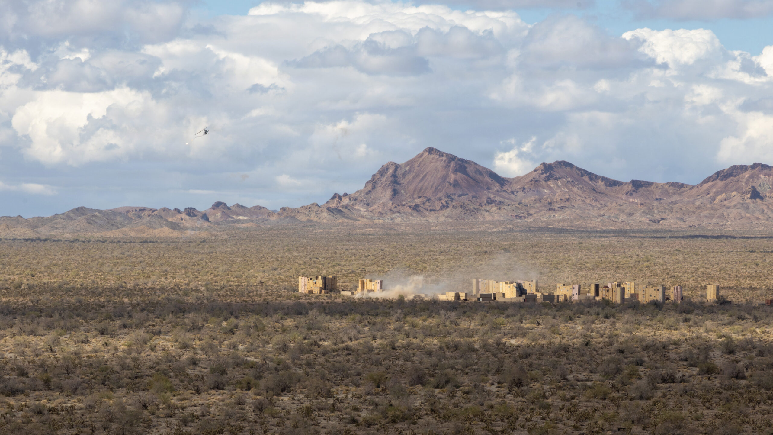
Images 11 and 15 show the objective area at scale. The Chocolate Mountain Aerial Gunnery Range’s mock city complex is a substantial installation, dozens of building facades of varying heights across a wide front, designed to replicate the visual and tactical geometry of an urban objective. Image 11 shows a helicopter visible far left of the city complex with a dust cloud rising from the objective area — the assault has begun. Image 15 shows the full assault at its peak: multiple helicopters which is identifiable by their large rotor diameter and fuselage mass as CH-53 series aircraft landing near the city complex, raising a massive brown dust cloud that extends across the entire width of the frame.
The scale of Image 15 is the visual argument for why AST-1 matters as a training event. The mock city is in the right frame. The dust cloud from multiple heavy helicopter landings fills the center. The Chocolate Mountain range rises behind it all. The individual elements that have been documented throughout this photographic series, the UAS assembled at OP4, the terminal controllers on the ridge, the UH-1Ys at the rocky LZ, the observer with his radio mast, are all converging on this moment.
What AST-1 Integrates
The fifteen photographs from April 13 at Chocolate Mountain document an exercise that is qualitatively different from every other event in the WTI 2-26 photographic series. The earlier articles in the series — the matting and FARP practical applications, the UAS tactics exercise, the night HIMARS off-load, the UH-1Y rappelling and door gun day —focused on a specific function or platform in relative isolation. AST-1 runs them all simultaneously.
The contractor UAS flying threat profiles over the range feeds the threat picture that the terminal controllers must account for. The UH-1Ys inserting the ground element must route to avoid the UAS threat while getting their passengers to the right position on time. The terminal control team must manage the aviation package against the objective while tracking the UAS overhead. The heavy assault helicopters must execute their approach and landing at the mock city in an airspace that is simultaneously contested and coordinated.
This is the kill web made kinetic: multiple nodes, sensors, assault aircraft, fire support, terminal controllers, threat simulators, working in a shared operational environment, each dependent on the others functioning correctly, the whole producing a combat outcome that none could generate alone.
The prospective WTI who planned and executed AST-1 at Chocolate Mountain on April 13, 2026, and then sat through the debrief that followed, carried something back to their squadron that could not be generated any other way: the experience of having run the integrated fight, with all of its friction, from the rocky climb to the observation point through the last helicopter lifting off the objective.
That is what WTI certifies. These photographs document why.