
By Robbin Laird
Nine photographs from April 4, 2026, at Yuma Proving Ground, Arizona, document the UAS tactics exercise conducted as part of Weapons and Tactics Instructor Course 2-26. The subject is the MQ-9A Reaper, operated in Marine Corps service by MAWTS-1, and the Ground Control Station from which its crew flies it. Together, the photographs provide the most analytically complete view of Marine Corps unmanned aviation integration in the WTI 2-26 series and one of the few public photographic records of the Marine MQ-9A program that includes both the aircraft and its operators at work.
The Marine Corps’ acquisition of the MQ-9A represented a significant doctrinal step: the move from small tactical UAS used primarily at the battalion level to a Group 5 large UAS capable of persistent surveillance, communications relay, and precision strike at operational range. MAWTS-1’s operation of the MQ-9A and its integration into WTI reflects the institutional judgment that unmanned aviation is not a niche capability managed separately from manned aviation. It is a function that every prospective WTI must understand and be able to integrate into the MAGTF’s kill web.
The Aircraft: MQ-9A at Yuma Proving Ground
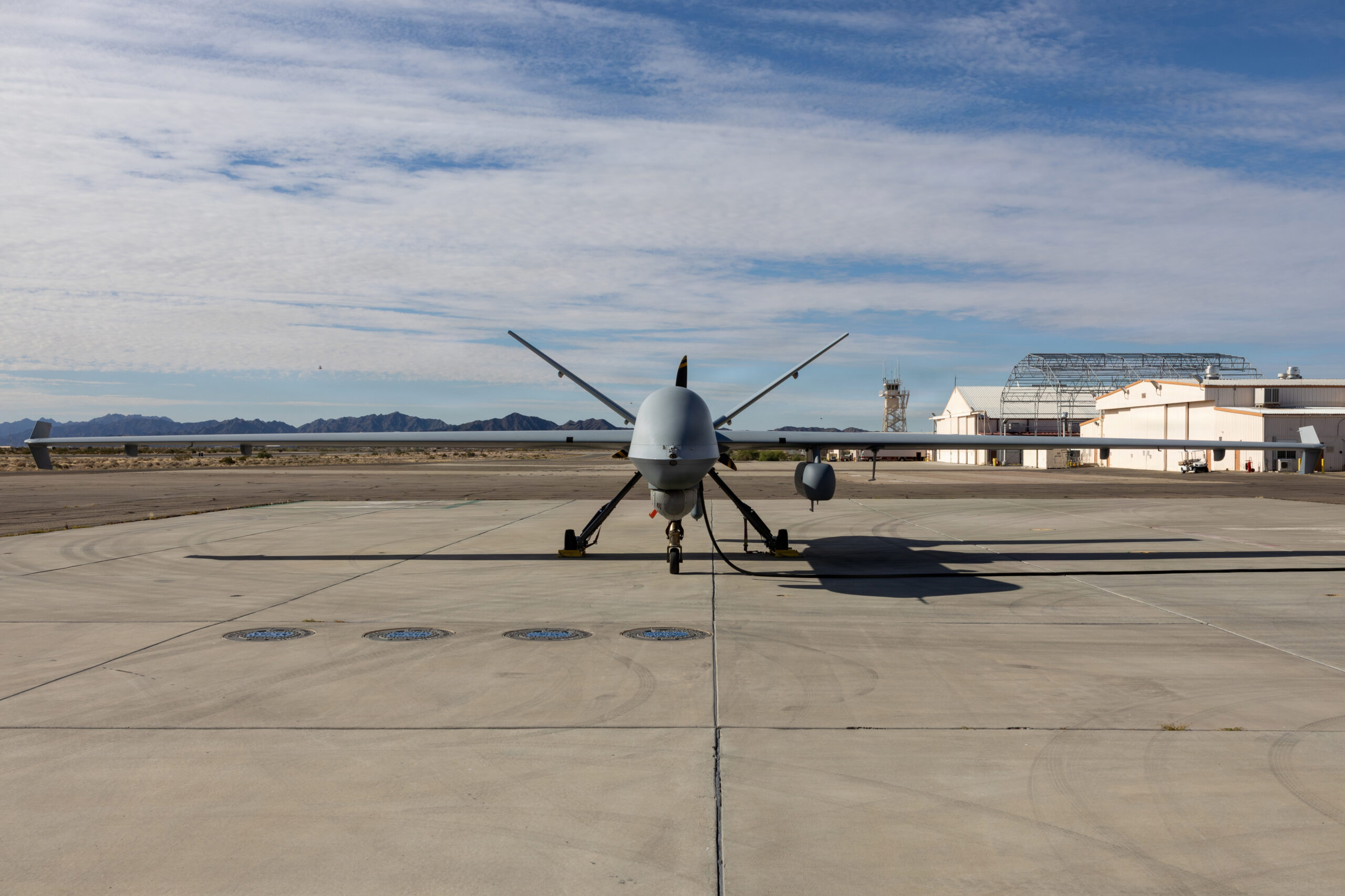
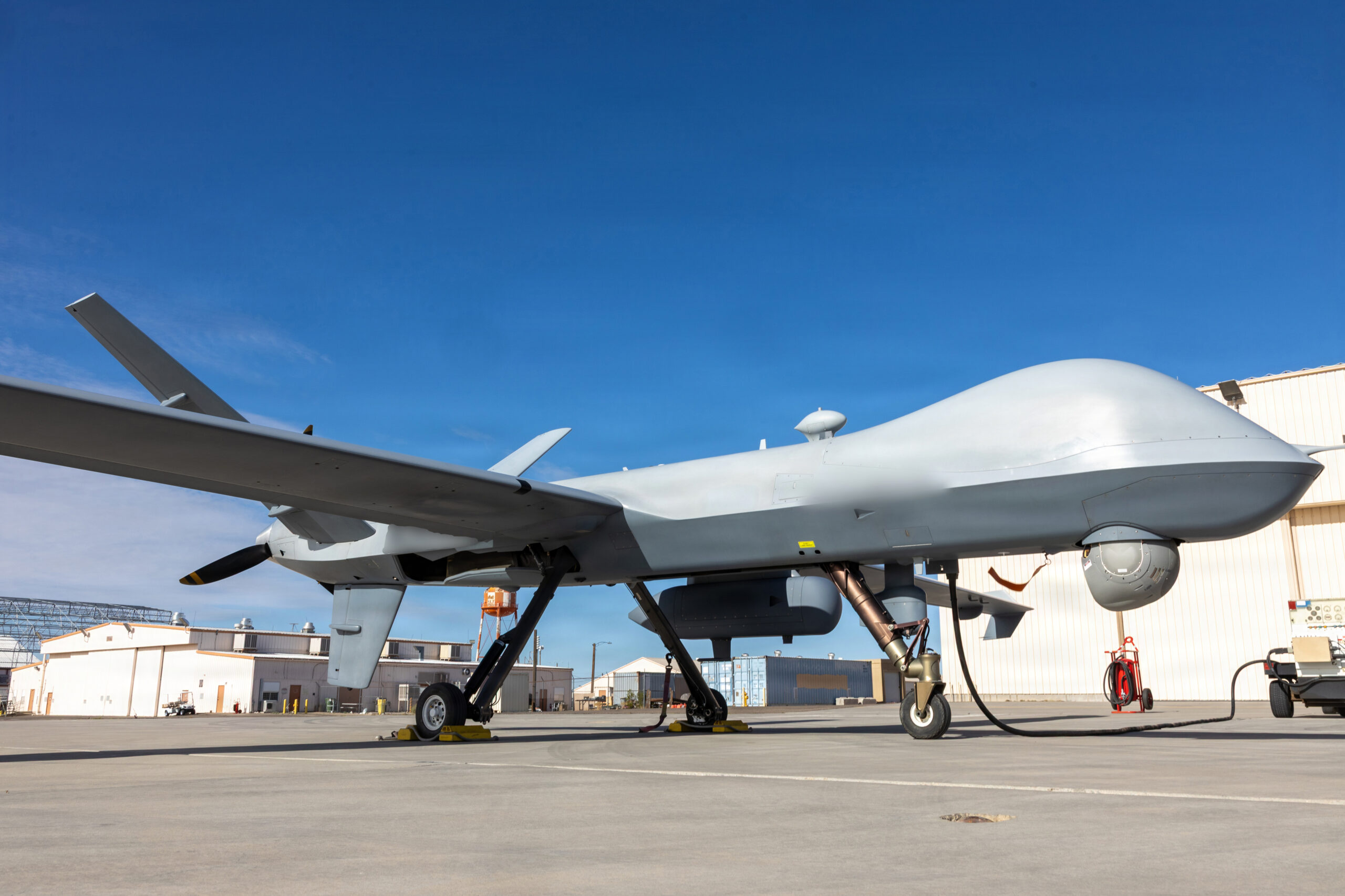
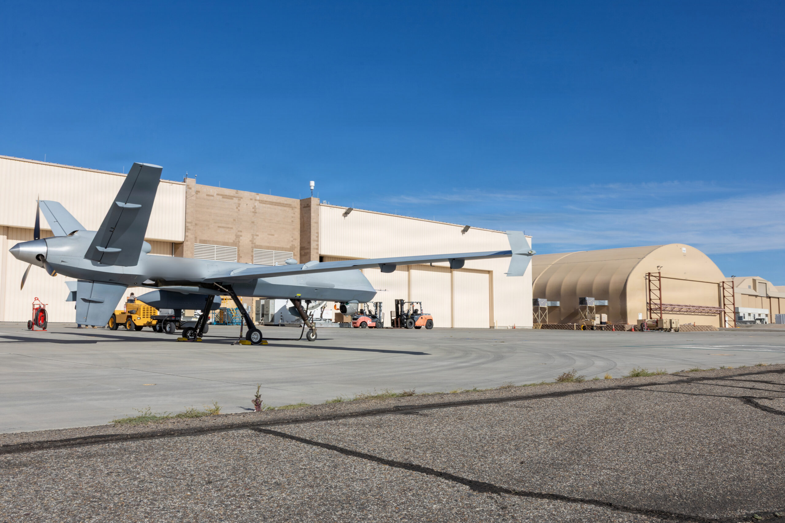
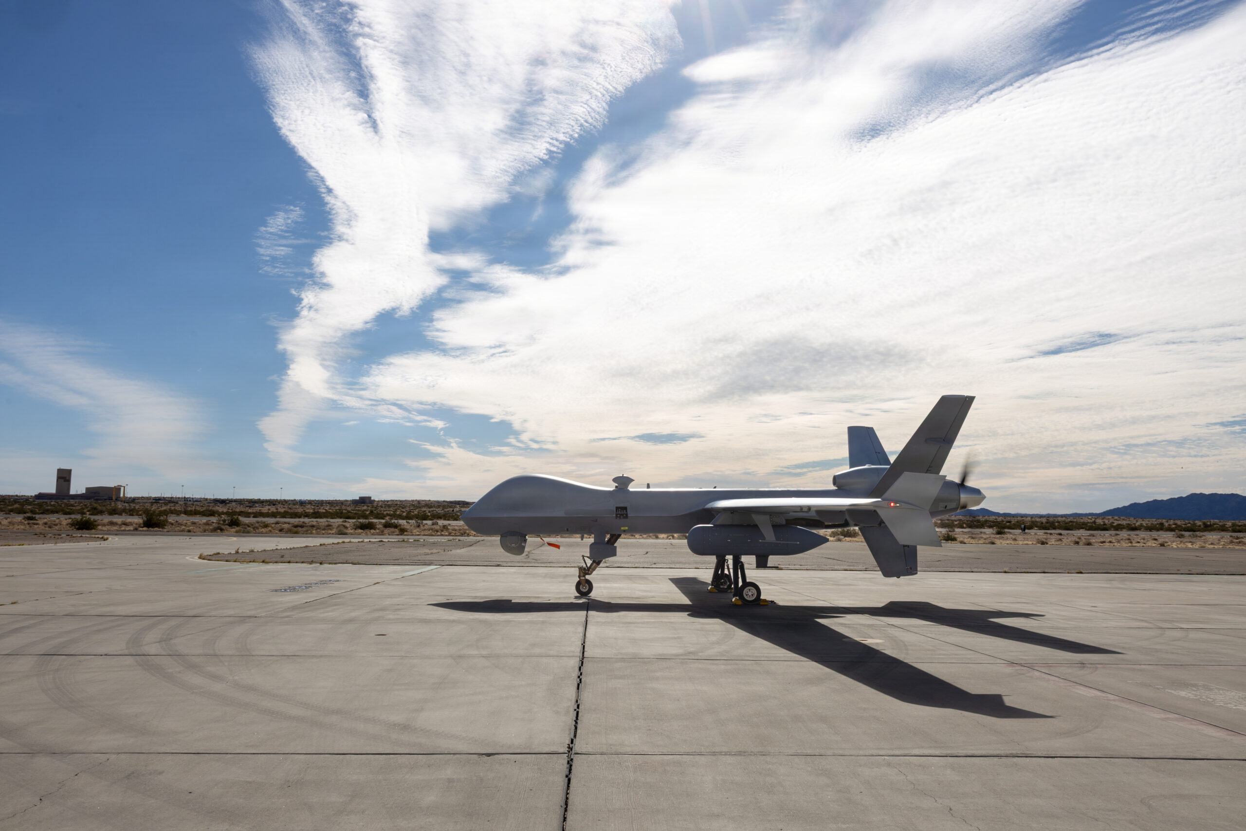
Images 1 through 4 show the MQ-9A on the ramp at Yuma Proving Ground in pre-launch configuration. The aircraft is in a clean loadout, no weapons visible on the wing hardpoints, consistent with a surveillance and integration-focused tactics exercise. The inverted-V tail, the high-aspect-ratio wing, and the multi-spectral sensor turret mounted under the forward fuselage are all visible in various angles across the four images.
The choice of Yuma Proving Ground as the operating location rather than MCAS Yuma is itself operationally significant. Yuma Proving Ground’s restricted airspace provides the separation from commercial and military traffic that large UAS operations require, and its runway and hangar infrastructure supports the ground power, data-link, and maintenance requirements of the MQ-9A’s operating system. Image 3 shows the aircraft from the rear quarter with the Proving Ground hangar complex behind it, forklifts moving equipment in the background, the scale of the facility visible. This is not a field deployment. It is a deliberate integration into a controlled airspace environment that allows the exercise to generate realistic sensor and data products that flow into the broader WTI tactical picture.
Image 2 provides the most technically detailed view of the aircraft: the low-angle perspective shows the under-fuselage sensor ball, the AN/DAS-1 Multi-Spectral Targeting System or equivalent, the exhaust stack of the turboprop engine, and the ground power unit cable still connected at the forward fuselage. The cable is the last physical connection between the aircraft and its ground support infrastructure; its disconnection is among the final steps before engine start. Image 4 shows the aircraft broadside on the ramp with the propeller beginning to turn, engine start, the aircraft transitioning from ground configuration to flight readiness.
The Ground Control Station: Where the Mission Is Flown
Images 5 through 9 document the interior of the Ground Control Station, the facility from which the MQ-9A’s crew flies the aircraft, manages its sensors, and integrates its data products into the broader tactical network. These photographs are analytically as important as the aircraft images, because they show the human dimension of unmanned aviation that is often absent from public coverage of the MQ-9 program.
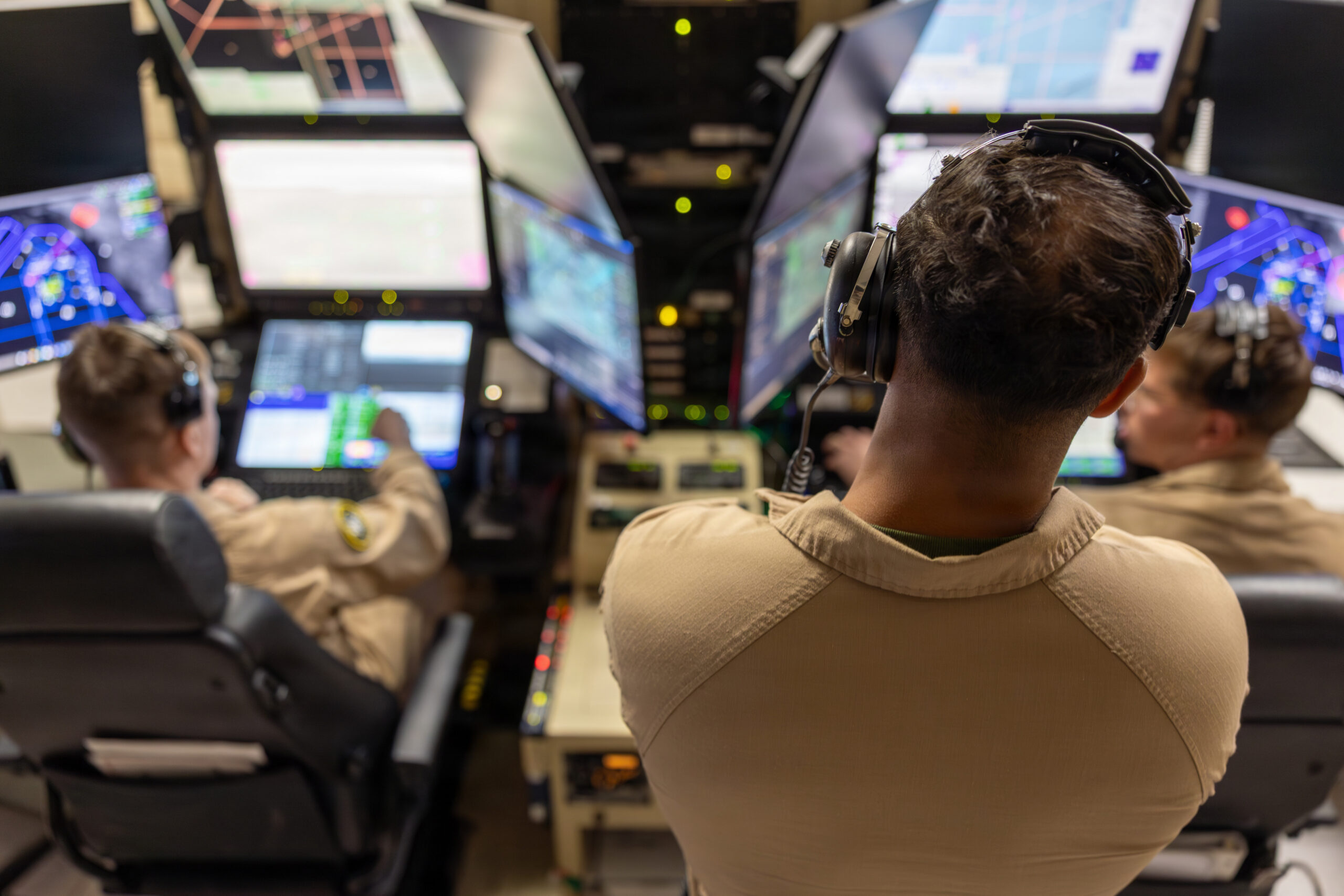
The GCS interior is a dense, screen-filled environment. Image 6 shows the full width of one control station: multiple monitors displaying moving-map data with overlaid tactical symbology, sensor feeds, and mission management interfaces. Two operators are visible from behind, both at keyboards and joysticks, headsets on. A third operator with a tablet stands behind them. The density of the display environment reflects the information load that the MQ-9A system generates: the aircraft’s sensors are producing continuous feeds of imagery, signals, and positional data that must be monitored, filtered, and acted upon in real time.
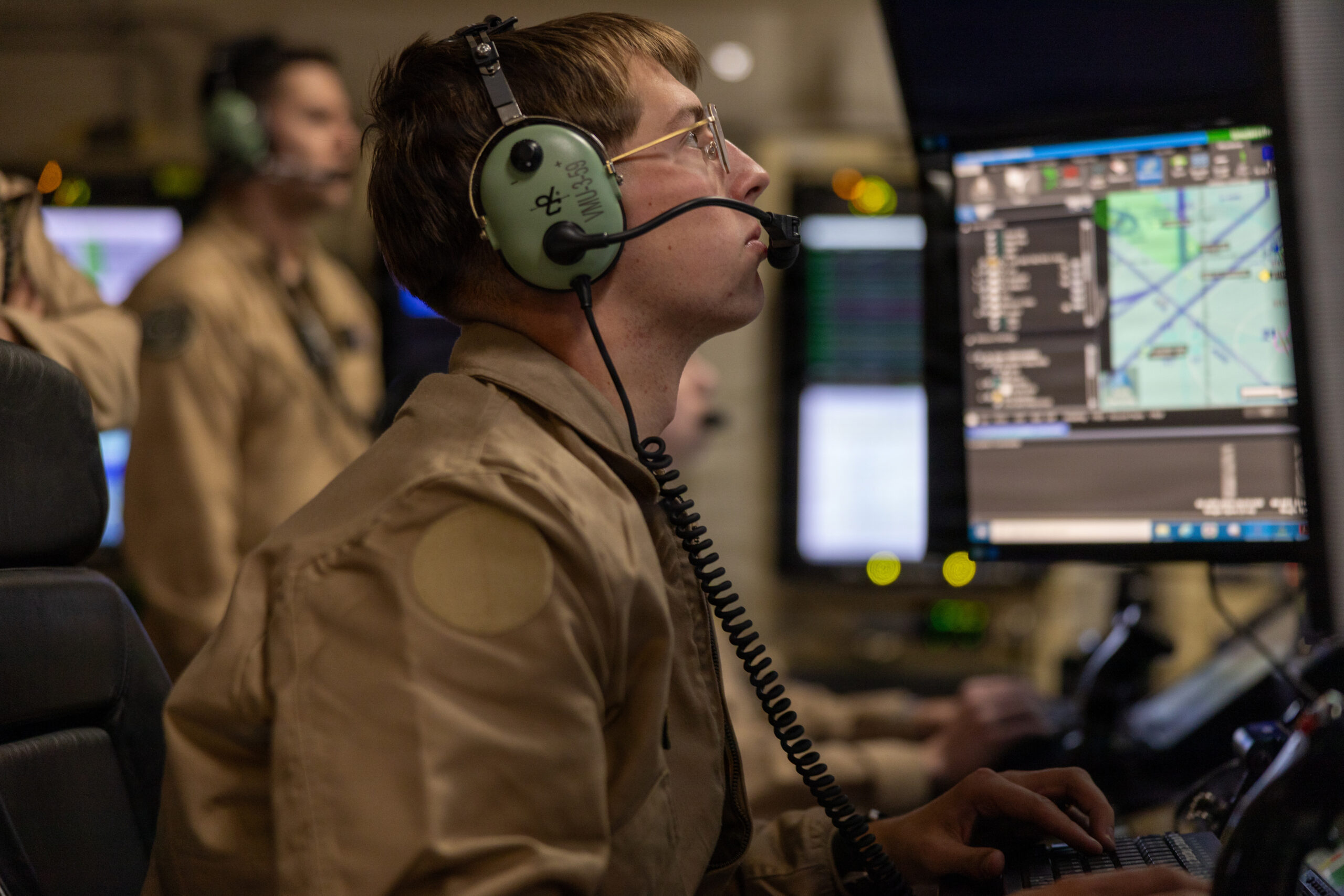
Image 5 shows a single operator at the controls, headset marked with what appears to be a VMU squadron designation, eyes looking upward toward the upper screen while his hands work the keyboard. The expression is one of active monitoring: something on the display is requiring attention, and the operator is processing it in the same way a manned aircraft pilot processes an instrument scan. The parallel is deliberate and real. Flying the MQ-9A demands the same situational awareness management, the same instrument scan discipline, and the same communication protocol adherence as flying a manned platform, executed from a chair inside a room rather than from a cockpit at altitude.
Image 7 provides the clearest view of the GCS control hardware: joystick controller, keyboard, the green-lit moving map showing the Yuma area airspace with waypoints and track lines overlaid, and a second map display in the upper right showing a broader area picture. The operator’s VMU-1 headset marking and the yellow MAWTS-1 patch on his flight suit confirm this is a MAWTS-1 instructor or student at the controls during the WTI exercise.
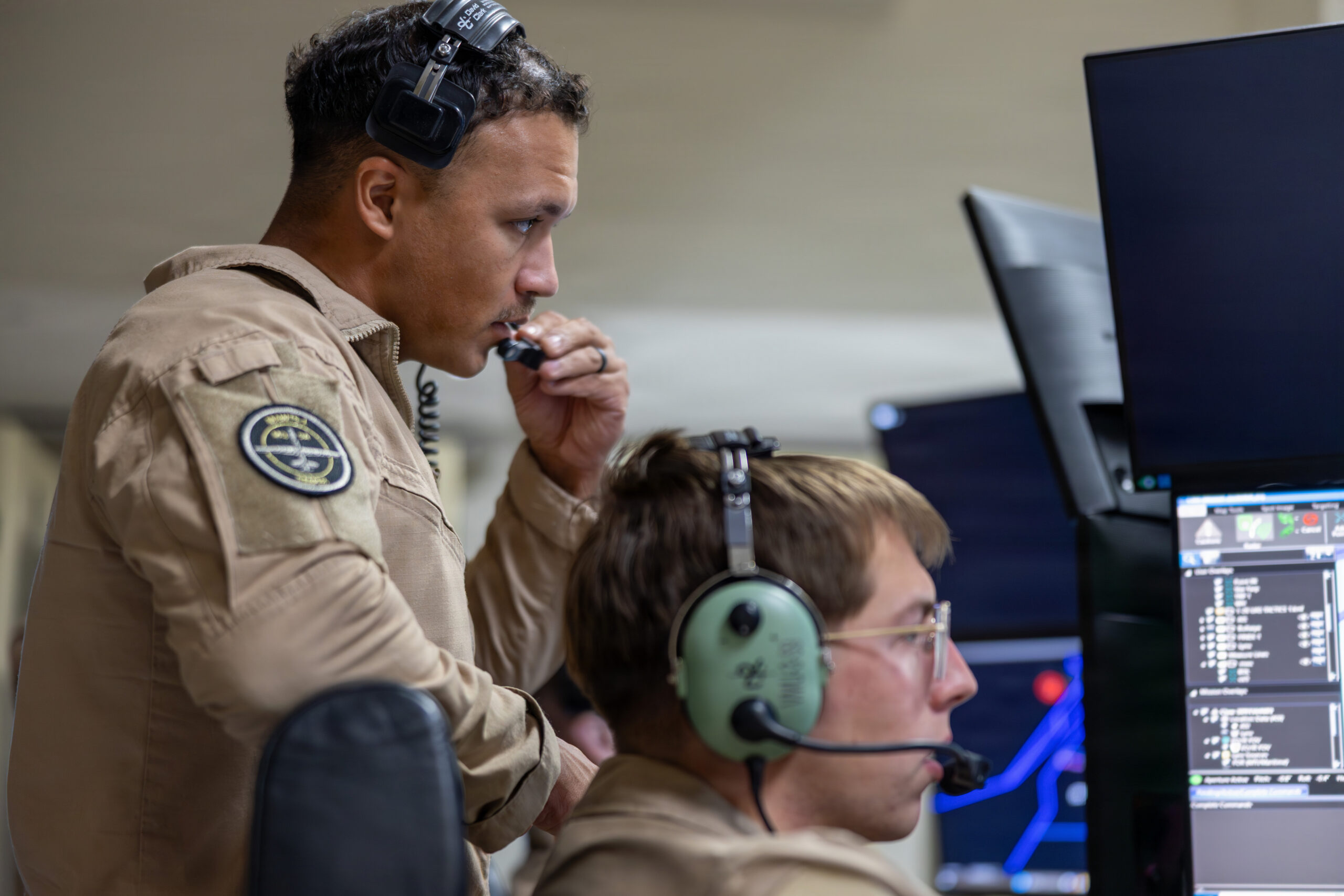
Image 8 is the most human image in the GCS set. A Marine with a MAWTS-1 squadron patch clearly visible on his sleeve stands behind the seated operator, radio handset to his mouth, eyes on the screens. This is the supervisory role in a GCS crew: the mission commander or instructor monitoring the operation, communicating with external parties, air traffic control, the exercise coordinator, or the tactical operations center integrating the MQ-9A’s data into the broader picture. His posture, standing, leaning slightly forward, radio in hand, is the posture of active management, not passive observation.
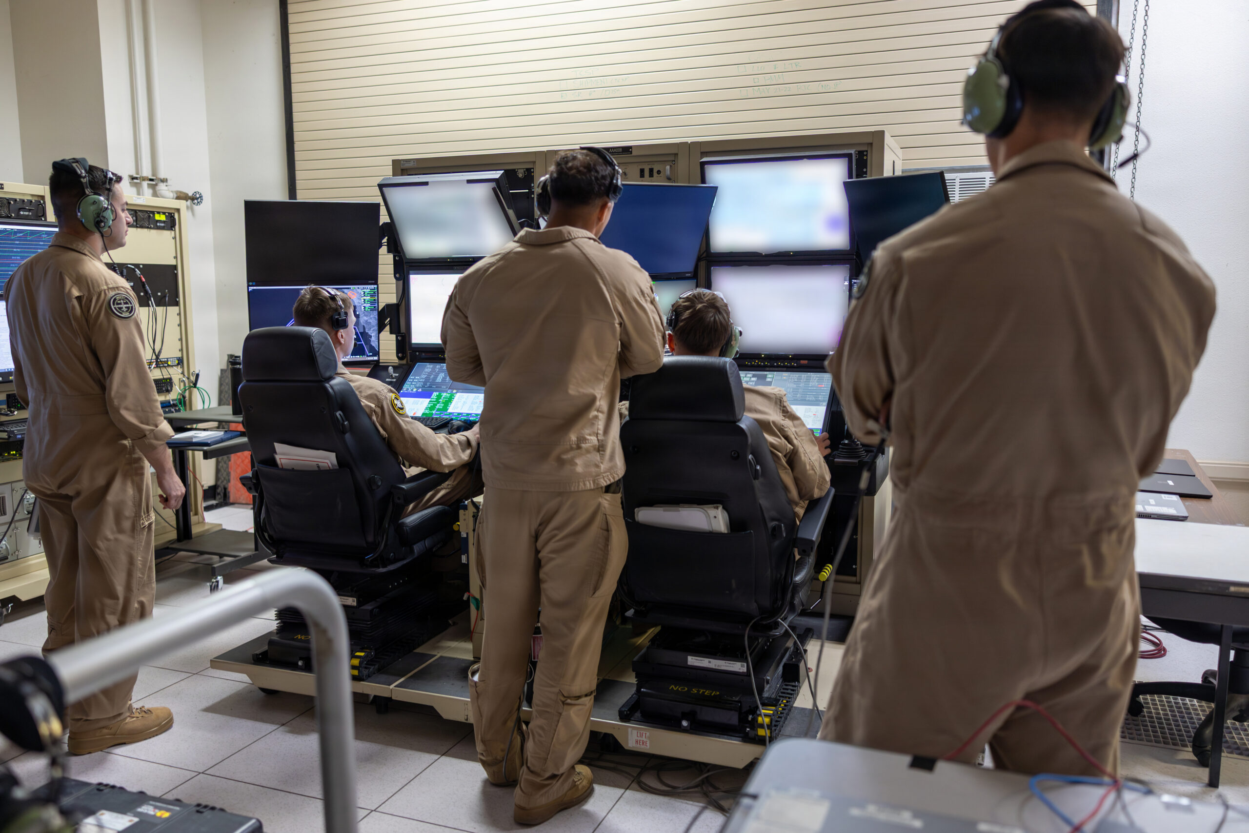
Image 9 shows the full GCS room from a wider angle: two control stations with two seated operators each, two additional personnel standing and monitoring, the equipment racks along the wall behind them. The room is neither large nor elaborate. It is a functional, purpose-built control environment that can in principle be transported and set up in the field, the deployed GCS concept that allows the MQ-9A to be operated from locations other than its home station. For WTI 2-26, the GCS is operating from Yuma Proving Ground. In a contingency, it could operate from a deployed expeditionary site.
The Marine MQ-9A: Platform, Program, and Purpose
The Marine Corps’ MQ-9A program, operated through Marine Unmanned Aerial Vehicle Squadrons under the 3rd Marine Aircraft Wing and integrated through MAWTS-1 for tactics development and instructor certification, represents the service’s investment in persistent, long-endurance ISR and strike at operational range. The MQ-9A can remain on station for over fourteen hours, carry a multi-spectral sensor suite capable of detecting and tracking targets at significant standoff, and employ precision-guided munitions under appropriate authorities.
In the context of the Marine Corps’ distributed operations concept for the Indo-Pacific, the MQ-9A’s endurance and sensor reach address a specific operational gap: the ability to maintain persistent awareness over maritime approaches, island chains, and littoral terrain without committing manned aircraft to the sustained overhead presence that would exhaust crews and consume maintenance resources. An MQ-9A operating from a forward expeditionary site, or remotely from a rear GCS, can maintain a continuous sensor picture over a sea lane or island chain for the duration of a tactical operation, feeding targeting data to HIMARS, cueing F-35B intercepts, or providing the situational awareness that allows dispersed ground forces to understand the operational picture.
WTI and UAS Integration: The Instructor Certification Requirement
The inclusion of the MQ-9A UAS tactics exercise in WTI 2-26 reflects a deliberate institutional decision by MAWTS-1: prospective Weapons and Tactics Instructors cannot be certified as competent in integrated MAGTF aviation without understanding how unmanned systems are employed, coordinated, and integrated with manned platforms in the kill web.
This is not a theoretical requirement. In the scenarios that WTI builds, anti-air warfare, assault support, close air support, fires integration, the MQ-9A is a node that can be generating the sensor picture that enables every other function. The WTI student who has flown a sortie in the GCS, managed the sensor tasking, and coordinated the MQ-9A’s data products with the manned platforms in the exercise understands the integration in a way that a student who only read about it cannot. The April 4 exercise at Yuma Proving Ground was building that understanding.
The kill web is frequently described as a network of sensors, shooters, and decision-makers connected by data links and common operating pictures. The MQ-9A is one of the most important sensors in that network, not because of its weapons, but because of its persistence. A kill web that cannot see continuously cannot act continuously. The MQ-9A provides the continuous seeing. WTI 2-26 trained its prospective instructors to understand what that means, and how to integrate it into every other function in the Marine aviation toolkit.
The GCS as the New Cockpit
The five photographs of the Ground Control Station interior make an argument that the photographs themselves do not narrate but that the evidence supports: the GCS is a cockpit. The operator at the controls in Image 5 is flying an aircraft. The mission commander in Image 8 is managing an air operation. The discipline, the scan patterns, the communication protocols, the situational awareness requirements, all are present in the GCS just as they are in a manned cockpit, expressed through different hardware and experienced in a different physical environment.
This matters for how the Marine Corps trains its UAS operators and integrates them into the broader aviation community. MAWTS-1’s treatment of the MQ-9A as a WTI-certifiable platform, not a separate program managed by a different community but an aviation function that the same WTI curriculum must address, reflects an institutional understanding that unmanned aviation is not a specialty track. It is aviation. The operator in the GCS is a Marine aviator. The aircraft on the Yuma Proving Ground ramp is a Marine aircraft. WTI 2-26 trained them together.